Belanglo State Forest
30 km
distance
2h
Contour time
8.1
avg score
Unsealed
surface
Scenery
New South Wales
The Southern Highlands sit between Sydney and Canberra on the inland side of the Illawarra escarpment. The nearest...
Road quality
8.1 RQS
Strong. Above average on most quality signals.
Accessibility
Fully sealed
Best in 4WD. Peak season: Year-round.
7-day forecast
Easy fire trail and forest track driving suitable for beginners and those wanting a low-commitment day out. No serious technical challenges. The main hazard is getting lost due to poor signage at intersections.
Scored 8.1/10 by Contour's road quality algorithm across curviness, surface, elevation and traffic. Best suited for 4wd drivers.
The road
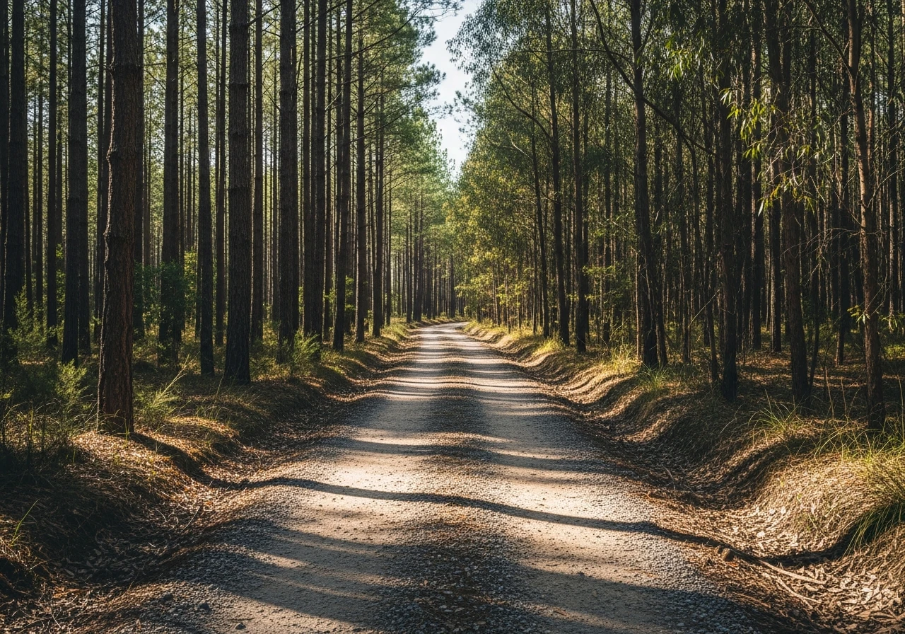
Belanglo State Forest is a 3,800-hectare state forest 90 minutes south-west of Sydney, managed by Forestry Corporation NSW. The 4WD tracks through the forest are easy Grade 2 fire trails and forest roads that loop through alternating sections of pine plantation and native eucalypt bush. This is a beginner's track by any measure - the surfaces are graded gravel and compacted dirt, the gradients are gentle and the creek crossings are shallow. What makes Belanglo more than just a drive through a pine plantation is the navigation element. The forest has an extensive network of fire trails and access roads, many of which are unsigned or signed with numbers that do not appear on standard mapping apps. Getting lost is common and part of the experience. A GPS or downloaded offline map is useful but part of the appeal is working through the intersections by terrain reading and general direction. The forest sits on the Southern Highlands plateau at around 600 metres, and the native bush sections are open ironbark and stringybark woodland with a grassy understorey. The pine sections are darker, denser and oddly quiet - the planted rows create long straight lines that contrast sharply with the natural bush. Dalys Clearing is the main gathering point and camping area - a large open space at the intersection of several tracks, with fire rings and basic facilities. The forest is popular on weekends with 4WD clubs running training days and new owners wanting to test their vehicles without the commitment of a remote track. It is also used by mountain bikers and horse riders on the broader fire trails.
Belanglo State Forest is a 3,800-hectare state forest 90 minutes south-west of Sydney, managed by Forestry Corporation NSW.
Why this road
The region
The Southern Highlands sit between Sydney and Canberra on the inland side of the Illawarra escarpment. The nearest towns are Moss Vale and Berrima - both have full services and Berrima in particular is worth a stop for its intact Georgian buildings and the Berrima Gaol complex. The Highlands have a cooler climate than the coast, with frosts common in winter and the bush taking on a dry, open character.

Before you go
Fuel at Moss Vale or Berrima before entering the forest. The tracks are open year-round and accessible in most weather. After heavy rain some of the clay sections become soft but not impassable. Phone coverage is patchy throughout the forest. Camping is permitted at Dalys Clearing and other designated sites - no bookings required. The forest is shared with logging trucks on weekdays - give way to forestry vehicles. Download an offline map before entering as the intersection signage is unreliable.
See a routing error?
Flag itWorth stopping for
Berrima
One of Australia's best-preserved Georgian villages, 15 minutes from the forest. The Surveyor General Inn has been serving since 1834.
Fitzroy Falls
A 30-minute drive east to a dramatic waterfall dropping 81 metres into the Kangaroo Valley - sealed road access and a viewing platform.
Route
Start
Dalys Clearing
End
Dalys Clearing (circuit)
Gallery

More roads like this
