Barretts Road
6.5 km
distance
45 min
Contour time
3.3
difficulty
Unsealed
surface
Scenery
Tasmania
The northwest coast of Tasmania between Penguin, Ulverstone and Devonport is dairy and vegetable farming country -...
Road quality
Grade 3.25
Every segment scored on 40+ data signals.
Accessibility
Fully sealed
Best in 4WD. Peak season: Summer-Autumn.
7-day forecast
Northwest Tasmania farm fringe track with moderate to high difficulty. The basalt loam surface is extremely slippery when wet - and wet is the default condition in northwest Tasmania. All-terrain tyres are strongly advised.
Recommended gear: Recovery boards, Snatch strap, Waterproof gear.
The road
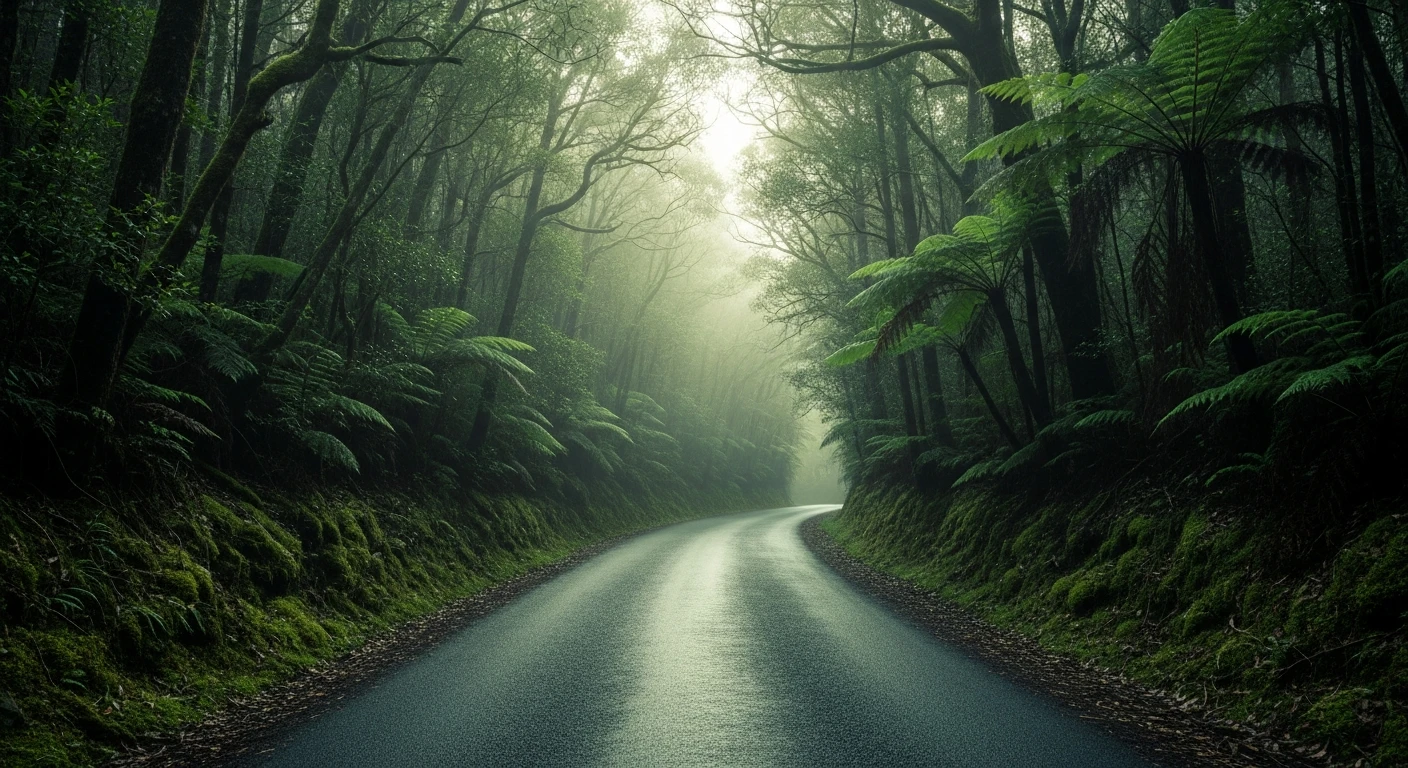
Barretts Road is a northwest Tasmania farm-fringe track that teaches you about the region's volcanic soil character. The 6.5-kilometre route near Ulverstone crosses basalt loam that is extraordinarily slippery when wet - and wet is the default condition in northwest Tasmania. The dairy country here is Tasmania's most productive agricultural region, and the transition from sea-level dairy to old-growth rainforest on the Dial Range happens in 20 minutes. The track suits drivers who want a moderate challenge close to the north coast towns without committing to a full west coast expedition. Penguin 15 minutes east has a Little Penguin colony at the town beach accessible at dusk.
Barretts Road is a northwest Tasmania farm-fringe track that teaches you about the region's volcanic soil character.
Why this road

The region
The northwest coast of Tasmania between Penguin, Ulverstone and Devonport is dairy and vegetable farming country - Tasmania's most productive agricultural region. The basalt soils from ancient volcanic activity produce some of Australia's finest pasture. Behind the coast the land rises quickly to the Dial Range and the northern edge of the Tarkine. The transition from sea-level dairy to old-growth rainforest in 20 minutes is one of northwest Tasmania's defining characteristics.

Before you go
Fuel in Ulverstone or Devonport. Northwest Tasmania has high rainfall year-round - the basalt surface becomes extremely slippery in wet conditions. Summer and early autumn are the drier months. All-terrain tyres advised. Not a remote track - help is close - but still deserves proper vehicle preparation.
See a routing error?
Flag itWorth stopping for
Dial Range forest walks
The Dial Range behind Ulverstone has good half-day walking through old-growth myrtle beech and blackwood - one of the better accessible rainforest walks in northwest Tassie.
Penguin town
A small coastal town 15 minutes east with good cafes, a surf beach and the Little Penguin colony at the town beach accessible at dusk.
Route
Start
Northwest Tasmania, Ulverstone region
End
Barretts Road end
Gallery

More roads like this