Abercrombie River National Park
50 km
distance
5h
Contour time
7.4
avg score
Unsealed
surface
Scenery
New South Wales
The Abercrombie region sits on the southern edge of the central tablelands, between Bathurst and Goulburn. It is dry,...
Road quality
7.4 RQS
Strong. Above average on most quality signals.
Accessibility
Fully sealed
Best in 4WD. Peak season: March-November.
7-day forecast
This is a serious track. The river crossings are deep and the descents are steep with loose surfaces. Stock 4WDs can manage in dry conditions but recovery gear is essential - a solo vehicle without a winch or recovery boards is taking a genuine risk. Travel in pairs where possible.
Scored 7.4/10 by Contour's road quality algorithm across curviness, surface, elevation and traffic. Best suited for 4wd drivers.
The road
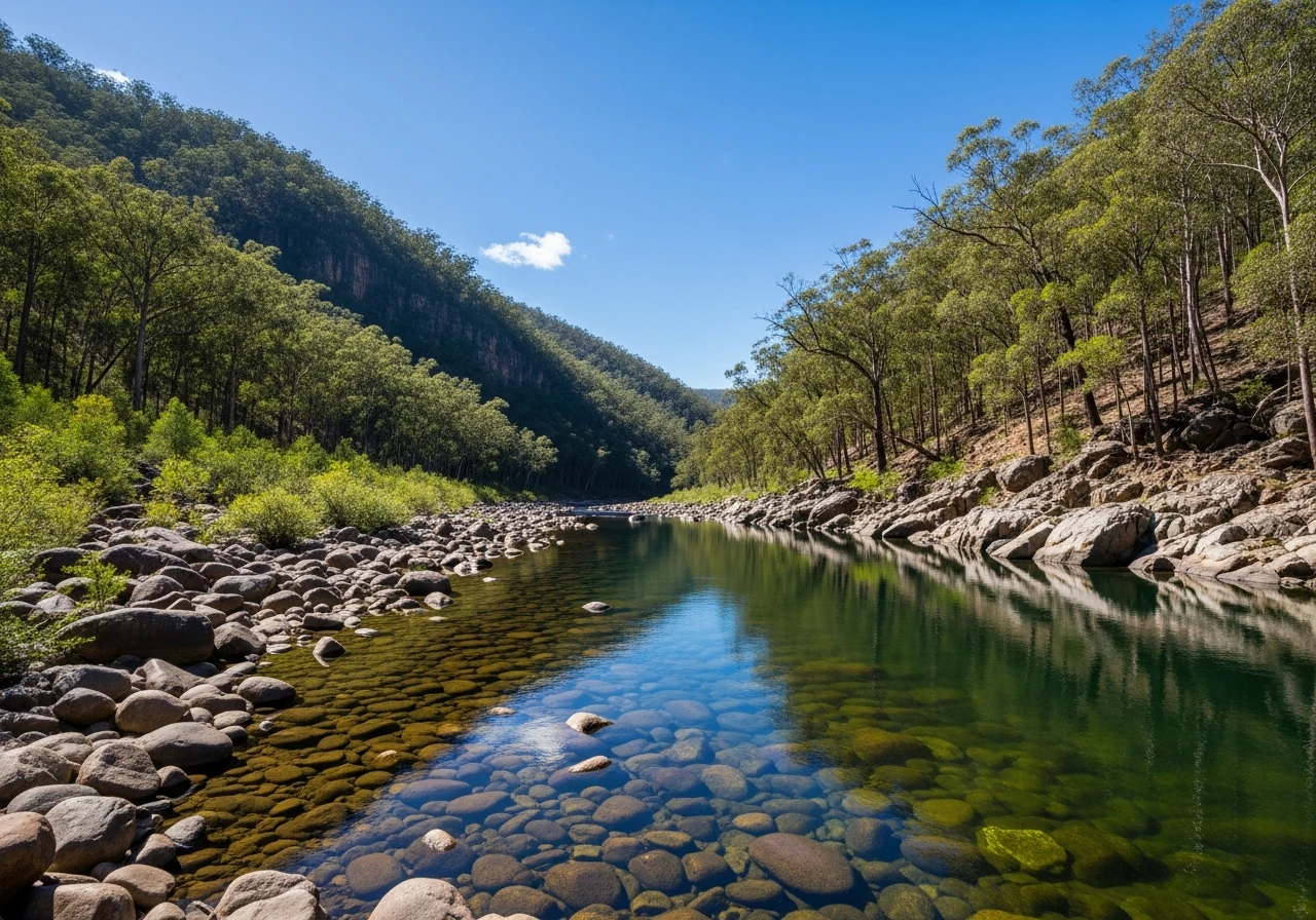
Abercrombie River National Park is one of the more serious 4WD destinations within reach of Sydney. The park covers the deeply incised valleys of the Abercrombie River and its tributaries south of Bathurst, with an elevation range from 400 metres at the river to over 1,000 metres on the surrounding ridgelines. The 4WD loop from Arkstone Road drops from the ridgetop through dry forest on increasingly steep and rocky track before reaching the river crossings at the bottom. The Abercrombie River crossings are the defining feature. In low water they are knee-deep with a firm rocky bottom. After rain they become impassable and there is no alternative exit - you wait or you turn back. The track on the far side climbs steeply through ironbark and stringybark forest, gaining elevation on narrow sidecut track with limited room for error. The country here feels genuinely remote despite being only 200 kilometres from Sydney. The forest is dense, the ridgelines block any long views and the river crossings commit you to the loop once you are across. The park is managed by NSW National Parks with minimal infrastructure. There are no formed campsites, no signage worth relying on and no phone coverage. A GPS with the track loaded is strongly recommended. The geology through the park transitions from granite on the ridgetops to slate and quartzite in the valley - visible in the river bed rocks and the exposed road cuttings on the descents. Wildlife is abundant, particularly wallabies and wombats on the river flats, and wedge-tailed eagles working the thermals above the ridgelines.
Abercrombie River National Park is one of the more serious 4WD destinations within reach of Sydney.
Why this road
The region
The Abercrombie region sits on the southern edge of the central tablelands, between Bathurst and Goulburn. It is dry, rugged country with deep river valleys cut into the plateau surface. The surrounding area is grazing land - merino sheep country that has looked much the same since the 1830s. The nearest towns with full services are Crookwell and Goulburn to the south or Bathurst to the north.

Before you go
Fuel at Bathurst, Crookwell or Goulburn before entering the park - there is nothing in between. The river crossings are impassable after significant rain and there is no alternative route. Check river levels before committing. Travel in pairs if possible. No phone coverage in the park. Carry a satellite communicator or PLB. The track is not recommended for solo vehicles without a winch. Allow a full day - the 50 km loop takes 5 hours with stops. Water from the Abercrombie River should be treated before drinking.
See a routing error?
Flag itWorth stopping for
Abercrombie Caves
A large natural limestone arch and cave system 30 minutes north of the park - worth a stop on the way in or out. Managed by NSW National Parks with self-guided walks.
Crookwell
A quiet tablelands town with fuel, pub meals and the wind farm visible on the ridgeline above.
Route
Start
Arkstone Road entrance
End
Felled Timber Road exit
Gallery

More roads like this
