Waterfall Way
185 km
distance
2h 30m
Contour time
8.2
avg score
Sealed
surface
Scenery
New South Wales
The New England Tableland is a high plateau running the length of northeast New South Wales at around 1,000 metres. The...
Road quality
8.2 RQS
Strong. Above average on most quality signals.
Accessibility
Fully sealed
Best in Motorbike & Rally. Peak season: Apr-Oct.
7-day forecast
One of the best motorbike roads in NSW. The escarpment section is continuous technical corners for 40 kilometres with almost no through traffic.
Scored 8.2/10 by Contour's road quality algorithm across curviness, surface, elevation and traffic. Best suited for motorbike & rally drivers.
The road
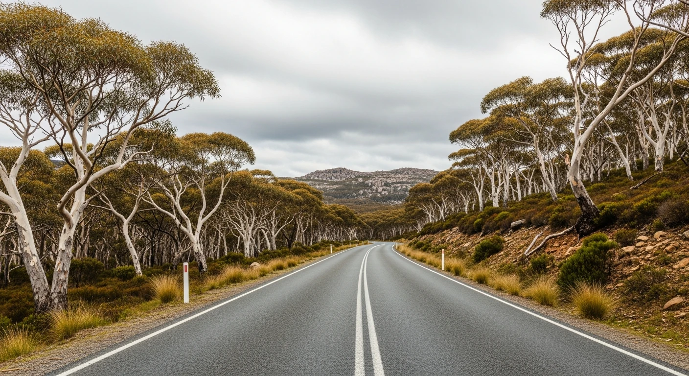
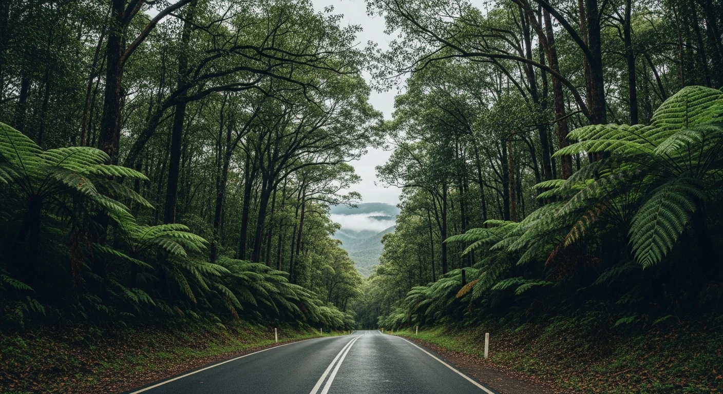
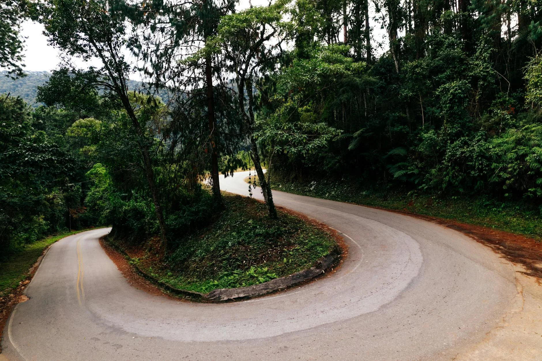
The Waterfall Way (B78) runs 185 kilometres from Armidale on the New England Tableland down the eastern escarpment to Coffs Harbour on the coast. The inland section from Armidale through Ebor is open and fast - tableland plateau with good visibility and easy progress. Then the road reaches the edge of the plateau and the escarpment begins. The 40-kilometre descent from the tableland to the coast is one of the best motorbike roads in New South Wales. The road engineers had to lose 1,000 metres of altitude through the edge of the plateau and the result is a continuous sequence of technical corners, crests and cambered bends through subtropical rainforest, passing the Dorrigo National Park and several waterfalls accessible from the road. The surface is well maintained and traffic is light on weekdays. The town of Dorrigo sits at the top of the escarpment section with a good pub and the entrance to the national park.
The Waterfall Way (B78) runs 185 kilometres from Armidale on the New England Tableland down the eastern escarpment to Coffs Harbour on the coast.
Why this road
The region
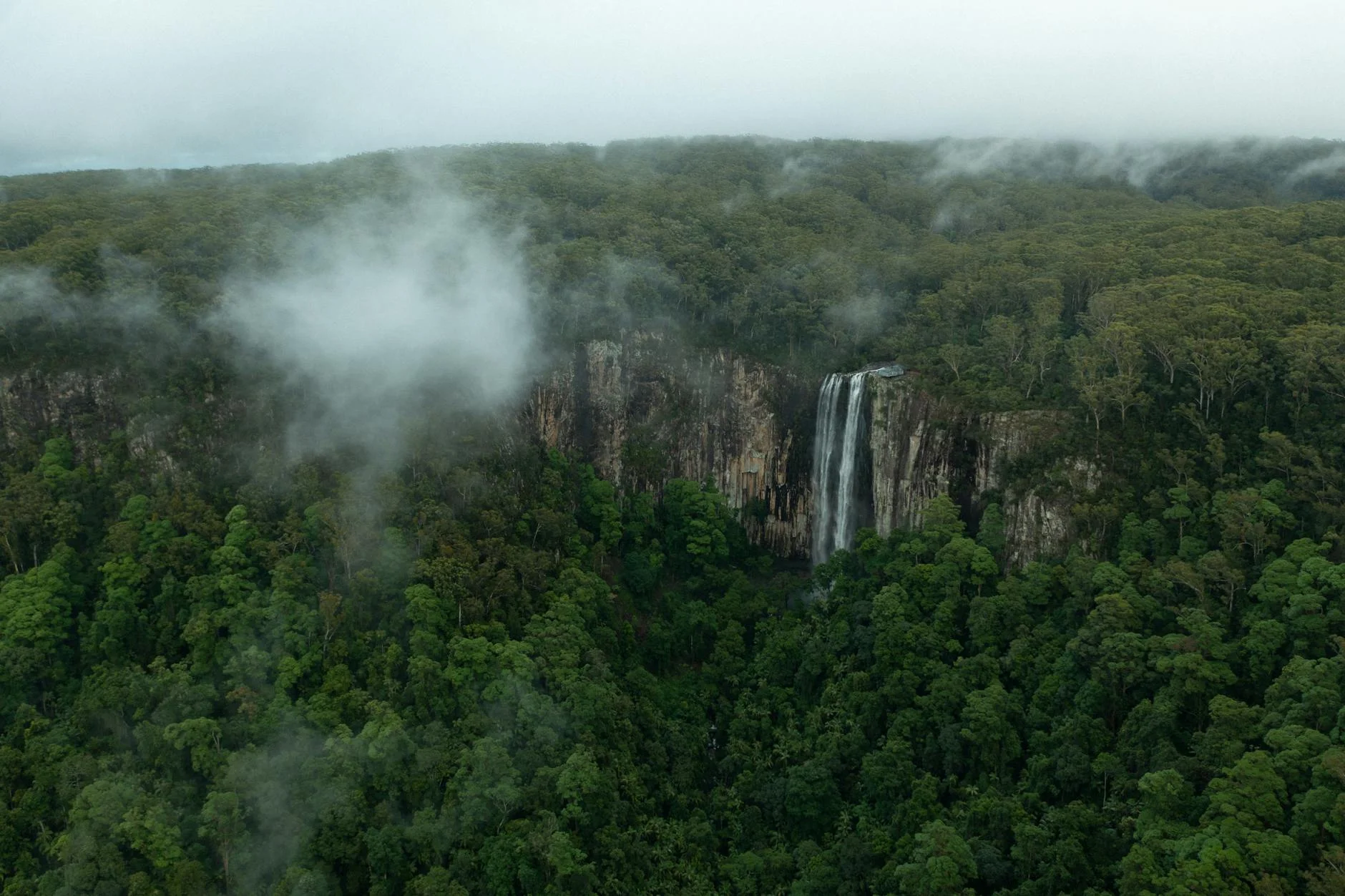
The New England Tableland is a high plateau running the length of northeast New South Wales at around 1,000 metres. The eastern escarpment drops sharply to the Mid North Coast and the rivers that flow from the plateau have carved deep valleys through the edge. The Dorrigo National Park on the escarpment is World Heritage listed and contains subtropical and cool-temperate rainforest in close proximity.
Before you go
Fuel in Armidale and Dorrigo. The Dorrigo National Park Skywalk is worth a stop at the top of the escarpment section. Coffs Harbour has full services at the coast. Best April to October when the tableland is clear and the surface dry.
See a routing error?
Flag itWorth stopping for
Dorrigo National Park Skywalk
Canopy walk over the rainforest at the top of the escarpment - good orientation before the descent.
Ebor Falls
Two-tiered waterfall on the Guy Fawkes River above the escarpment - a short detour from the main route near Ebor.
Route
Start
Armidale
End
Coffs Harbour
Gallery

More roads like this