Walls of Jerusalem Approach
102 km
distance
2h
Contour time
9.0
avg score
Mostly sealed, last 13 km gravel
surface
Scenery
Tasmania
The Walls of Jerusalem is surrounded by the Central Highlands World Heritage wilderness - the Cradle Mountain-Lake St...
Road quality
9.0 RQS
Exceptional. Consistently high curviness, surface, and low traffic.
Accessibility
Fully sealed
Best in 4WD. Peak season: November-April.
7-day forecast
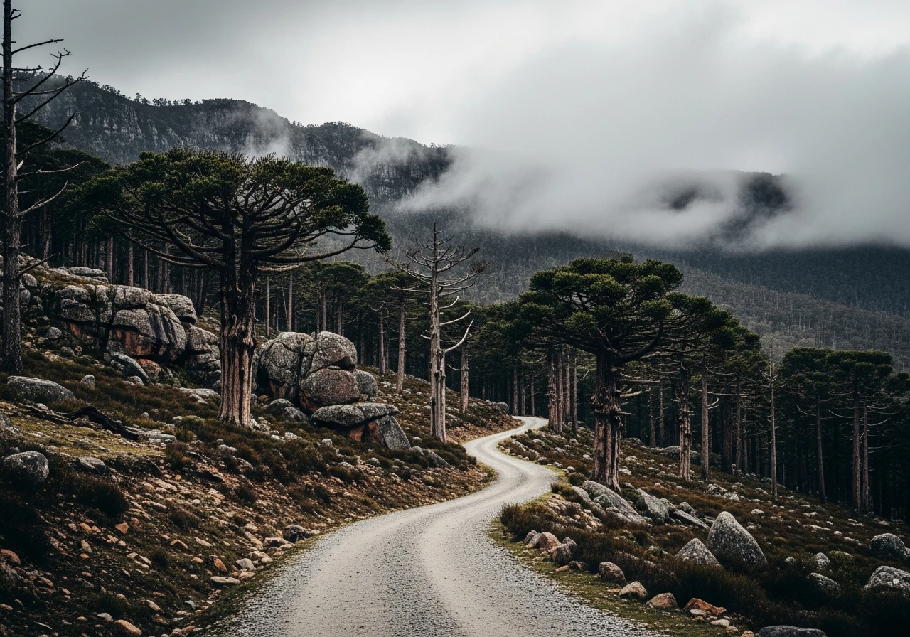
The approach road is unsealed gravel, well-maintained in summer. The last 10km climbs steeply through pencil pine country on a narrow single-lane track. A standard 2WD can make the lower sections but the steep upper section benefits from high clearance.
Scored 9.0/10 by Contour's road quality algorithm across curviness, surface, elevation and traffic. Best suited for 4wd drivers.
The road
The Walls of Jerusalem National Park is a dolerite plateau at 1,400m in the central Tasmanian wilderness. Getting there requires driving the unsealed approach road from Deloraine - a 55km run that climbs through cleared farming country, then native eucalypt forest, then the extraordinary pencil pine zone where ancient twisted pines cling to rocky ridgelines above the treeline. The plateau itself is accessible only by walking - the car park at the end of the road is the start of a 16km return walk to the Walls (8km each way). The Walls are a series of dolerite rock faces arranged around the high central basin - an ancient glaciated landscape with tarns, cushion plants and the silence of a place genuinely untouched. In Tasmanian terms, the Walls of Jerusalem is a serious objective. The weather changes instantly above 1,200m. Summer snow is possible. The park experiences every type of weather in every season.
The Walls of Jerusalem National Park is a dolerite plateau at 1,400m in the central Tasmanian wilderness.
Why this road
The region
The Walls of Jerusalem is surrounded by the Central Highlands World Heritage wilderness - the Cradle Mountain-Lake St Clair National Park to the west, the Mersey-Forth hydro system to the north. Deloraine is a charming small town in the Meander Valley with good cafes and accommodation. It makes the most logical base for the approach road.

Before you go
Fuel in Deloraine. The approach road is accessible to high-clearance 4WDs from November to April. The upper section can be blocked by snow as late as October and as early as May. The walk from the car park requires proper alpine gear even in summer. No facilities at the car park. The road is single-lane with limited passing places on the steep upper section.
See a routing error?
Flag itWorth stopping for
Deloraine township
One of Tasmania's most pleasant country towns - good food, craft shops and the Deloraine Museum covering the Meander Valley history.
Lake Mackintosh and Mackintosh Dam
The Hydro Tasmania dam system visible to the west of the approach road - an engineering contrast to the wilderness beyond.
Route
Start
Deloraine
End
Walls of Jerusalem car park
Gallery

More roads like this