Thomson River Road
42 km
distance
1h 50m
Contour time
3.0
difficulty
Unsealed
surface
Scenery
Victoria
Noojee is a small settlement at the edge of the Baw Baw plateau, 90 kilometres east of Melbourne. It has a pub, a...
Road quality
Grade 3
Every segment scored on 40+ data signals.
Accessibility
Fully sealed
Best in 4WD. Peak season: Autumn-Spring.
7-day forecast
River crossings and bush tracks through West Gippsland. Not technical but needs ground clearance. Avoid after heavy rain.
Recommended gear: Recovery boards, Snatch strap, Extra water.
The road
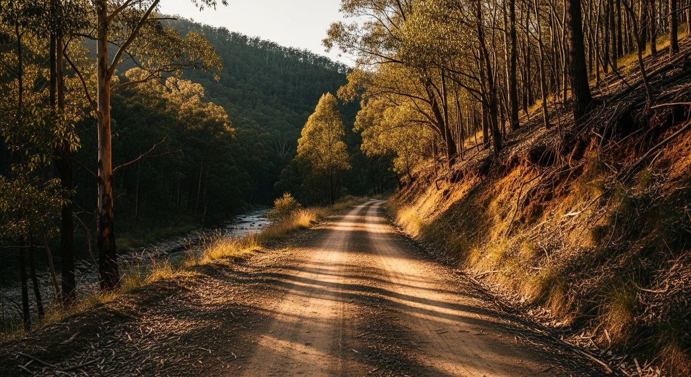
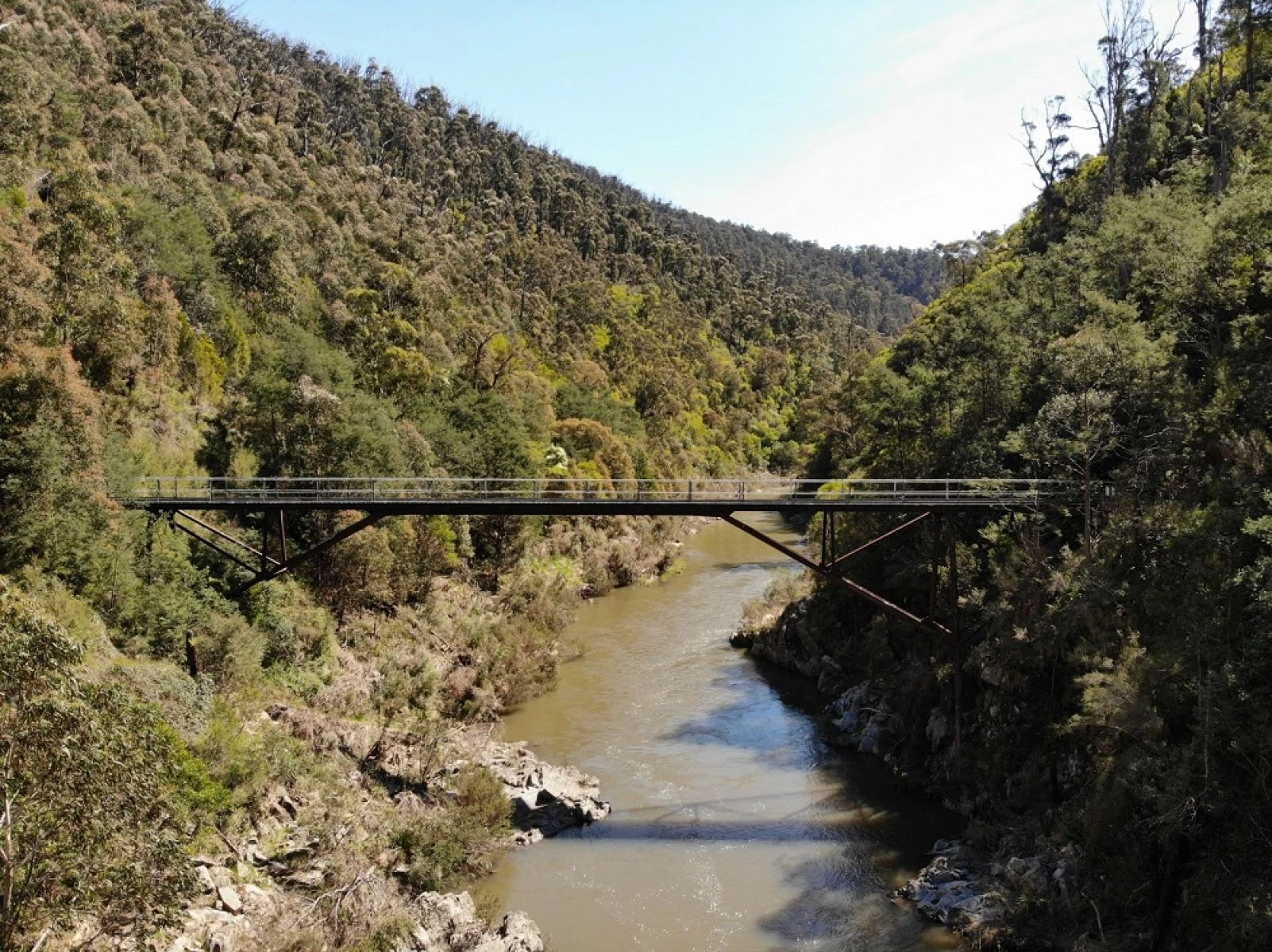
The Thomson River Road is a 42-kilometre unsealed track that follows the Thomson River through West Gippsland bush country between Noojee and Tanjil Bren. It is one of the more accessible 4WD tracks in Victoria without being boring about it. The track crosses the river several times - the crossings are shallow and well-defined in normal conditions but can become dangerous after heavy rain. The surrounding bush is mixed mountain ash and stringybark with a dense understorey, and the track keeps close to the river for most of its length. There are several clearing spots suitable for a stop and the forest closes in enough to feel genuinely away from things. A standard 4WD with 200mm of ground clearance handles this track comfortably in dry conditions. Modified vehicles find it too easy. The track is mostly used by locals who know it and the occasional overnight camper heading to one of the riverside clearings. Very few day-trippers end up here, which is part of its appeal.
The Thomson River Road is a 42-kilometre unsealed track that follows the Thomson River through West Gippsland bush country between Noojee and Tanjil Bren.
Why this road

The region
Noojee is a small settlement at the edge of the Baw Baw plateau, 90 kilometres east of Melbourne. It has a pub, a general store and a trestle bridge that was part of the Noojee railway line, closed in the 1950s. Tanjil Bren at the far end of the track is a cluster of houses with a recreation reserve and not much else. The Thomson catchment around both towns is part of Melbourne's water supply buffer and access to some areas is restricted. The West Gippsland bush here was heavily logged in the early 20th century and the regrowth forest is now mature enough to be genuinely impressive.

Before you go
Fuel at Noojee or Moe. The track is impassable after significant rain - the Thomson River crossings rise quickly and there is no safe alternative route out. Check river levels before going in winter or spring. No phone coverage along most of the track. Carry a recovery kit and let someone know your route. Basic mechanical preparation is worthwhile as you are 30-plus kilometres from sealed road at the midpoint.
See a routing error?
Flag itWorth stopping for
Noojee Trestle Bridge
The original timber trestle railway bridge above the Latrobe River, now a walking track with good valley views and interpretive signage about the old tramway.
Mount Baw Baw
30 minutes from Noojee on a sealed road - a good second road to add to the day if the Thomson River track finishes earlier than expected.
Route
Start
Noojee
End
Tanjil Bren
Gallery

More roads like this