Mount Arrowsmith
53 km
distance
1h 5m
Contour time
5.4
avg score
Sealed
surface
Scenery
Tasmania
The Lyell Highway connects Queenstown to Hobart via the central highlands, passing through the Franklin-Gordon Wild...
Road quality
5.4 RQS
Every segment scored on 40+ data signals.
Accessibility
Fully sealed
Best in Sports car. Peak season: Oct-Apr.
7-day forecast
Best in dry conditions - the west coast surface can be slippery after rain. Motorbike excellent in clear weather. Allow time: 53 km of varied west coast terrain is a proper stage.
Scored 5.4/10 by Contour's road quality algorithm across curviness, surface, elevation and traffic. Best suited for sports car drivers.
The road
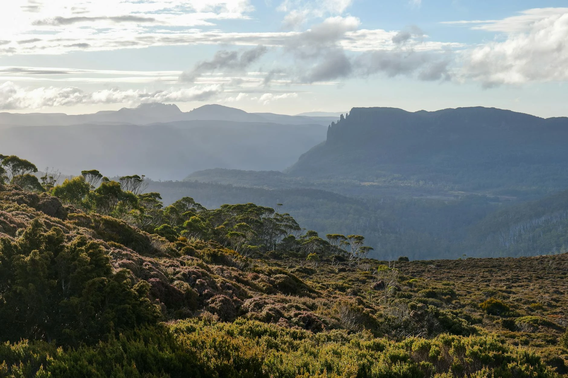
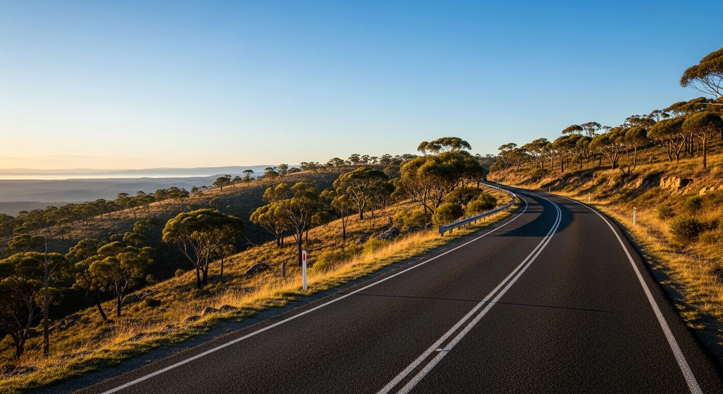
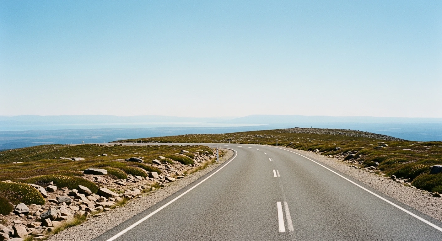
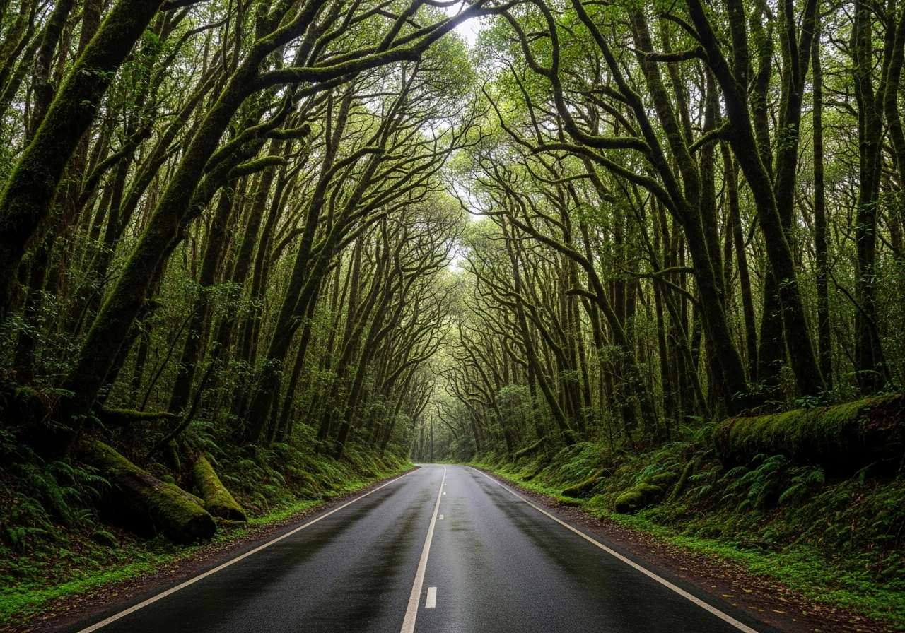
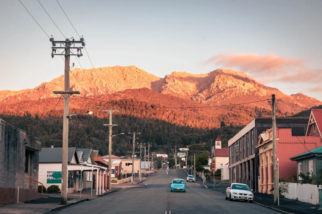
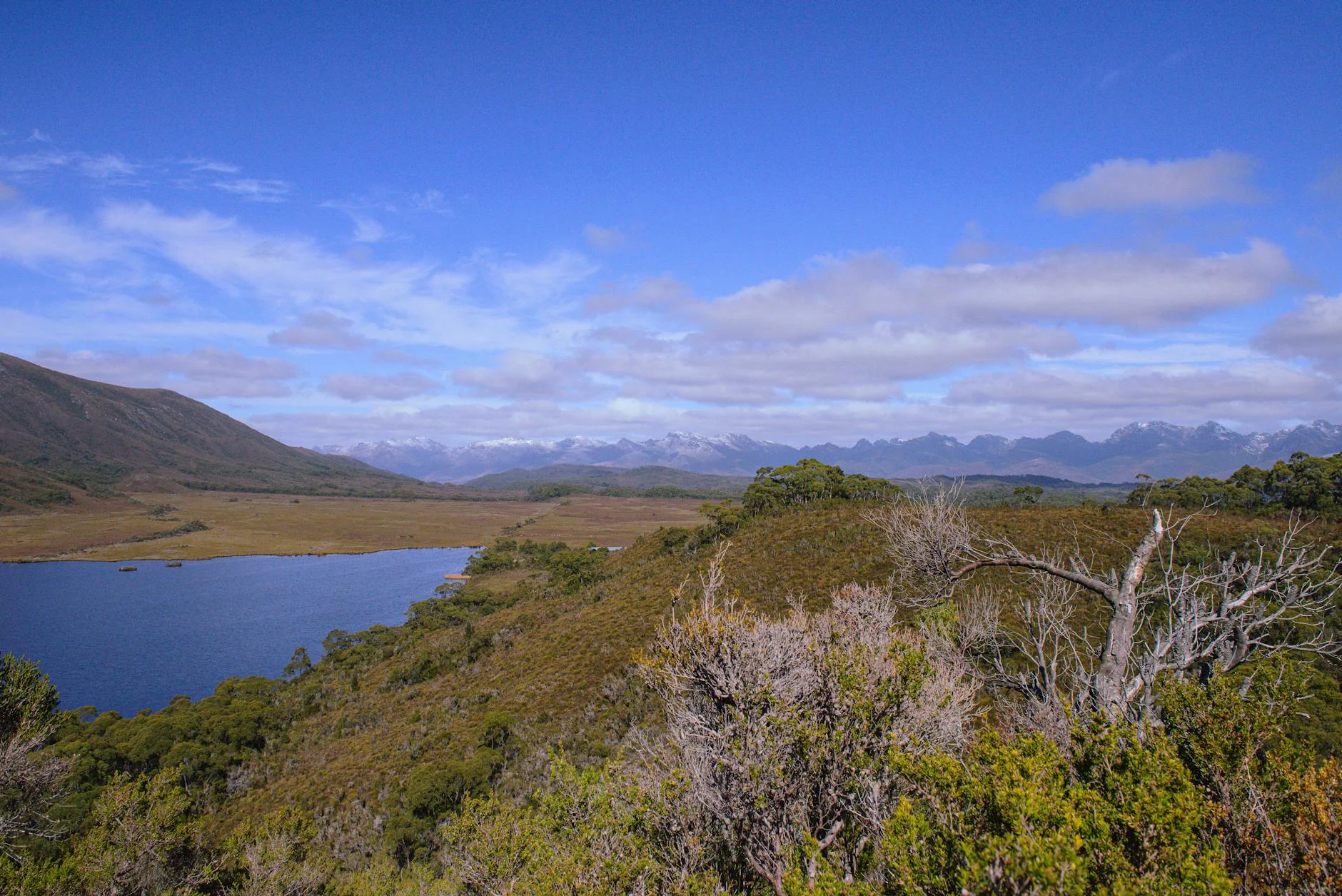
The Mount Arrowsmith stage is the longest in the Tasmania Tarmac collection and the one that can make or break competitor aspirations in Targa Tasmania. The 53-kilometre run along the Lyell Highway leaves the Queenstown area at Bradshaw Bridge - the span over Lake Burbury created when the King River was dammed - and climbs through the Franklin-Gordon Wild Rivers National Park to the Mount Arrowsmith plateau at 829 m, then descends toward the King William area near Derwent Bridge. Queenstown is one of Australia's most striking towns - a century of copper smelting stripped the surrounding hills of all vegetation, leaving bare multicoloured rock that glows orange, red and grey in late afternoon light. The road east from Bradshaw Bridge climbs immediately into dense cool-temperate rainforest. Myrtle beech and sassafras close overhead within the first few kilometres. The climb to the plateau is where the stage earns its reputation. The road is a mixture of fast open stretches and tight bends, with more than 400 metres of elevation change. On the plateau the trees clear and the scale of the west coast becomes apparent - ancient dolerite country with no human presence in any direction. The descent to the eastern end is committed and demands a reset after the caution required on the way up.
The Mount Arrowsmith stage is the longest in the Tasmania Tarmac collection and the one that can make or break competitor aspirations in Targa Tasmania.
Why this road
The region
The Lyell Highway connects Queenstown to Hobart via the central highlands, passing through the Franklin-Gordon Wild Rivers National Park. This is genuinely remote country. Queenstown's hills are stripped bare by acid rain from the copper smelters that ran until 1969 - the colours are extraordinary and unlike anywhere else in Australia. Rainfall on the west coast averages 2,500 mm per year.
History
Mount Arrowsmith (866 m) sits within the Franklin-Gordon Wild Rivers National Park. The Lyell Highway was rerouted when Lake Burbury was created by the damming of the King River, and Bradshaw Bridge (324 m long, 48 m pier height) was constructed to carry the highway over the new lake.
Before you go
Fuel in Queenstown before departure. The west coast surface is wet and can be mossy - check conditions after rain. The plateau section can be foggy at any time of year. Mobile coverage is absent for most of the stage. The road carries some tourist and logging traffic on weekdays.
See a routing error?
Flag itWorth stopping for
Queenstown Heritage Museum
The history of the copper mining boom and the environmental legacy of the smelters.
Lake Burbury
The reservoir formed by the damming of the King River, crossed by Bradshaw Bridge at the stage start.
Route
Start
Bradshaw Bridge (Lyell Hwy)
End
Near Derwent Bridge
Gallery
More roads like this