Palmerston Highway
55 km
distance
1h
Contour time
5.3
avg score
Sealed
surface
Scenery
Queensland
The Palmerston Highway connects the Atherton Tablelands to the Cassowary Coast via the Wet Tropics World Heritage Area....
Road quality
5.3 RQS
Every segment scored on 40+ data signals.
Accessibility
Fully sealed
Best in Sports car. Peak season: Apr-Oct.
7-day forecast
Exceptional sports car and motorbike road. The descent demands braking discipline from top to bottom. Best driven April to October in dry conditions.
Scored 5.3/10 by Contour's road quality algorithm across curviness, surface, elevation and traffic. Best suited for sports car drivers.
The road
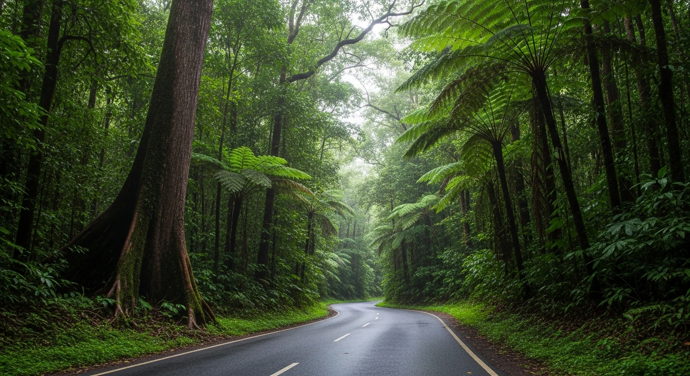
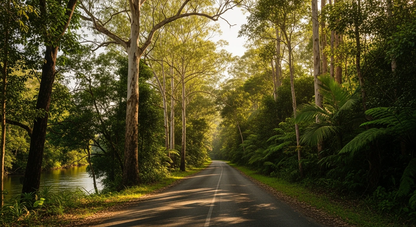
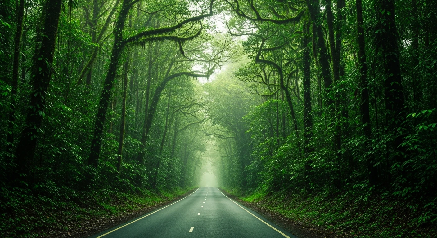
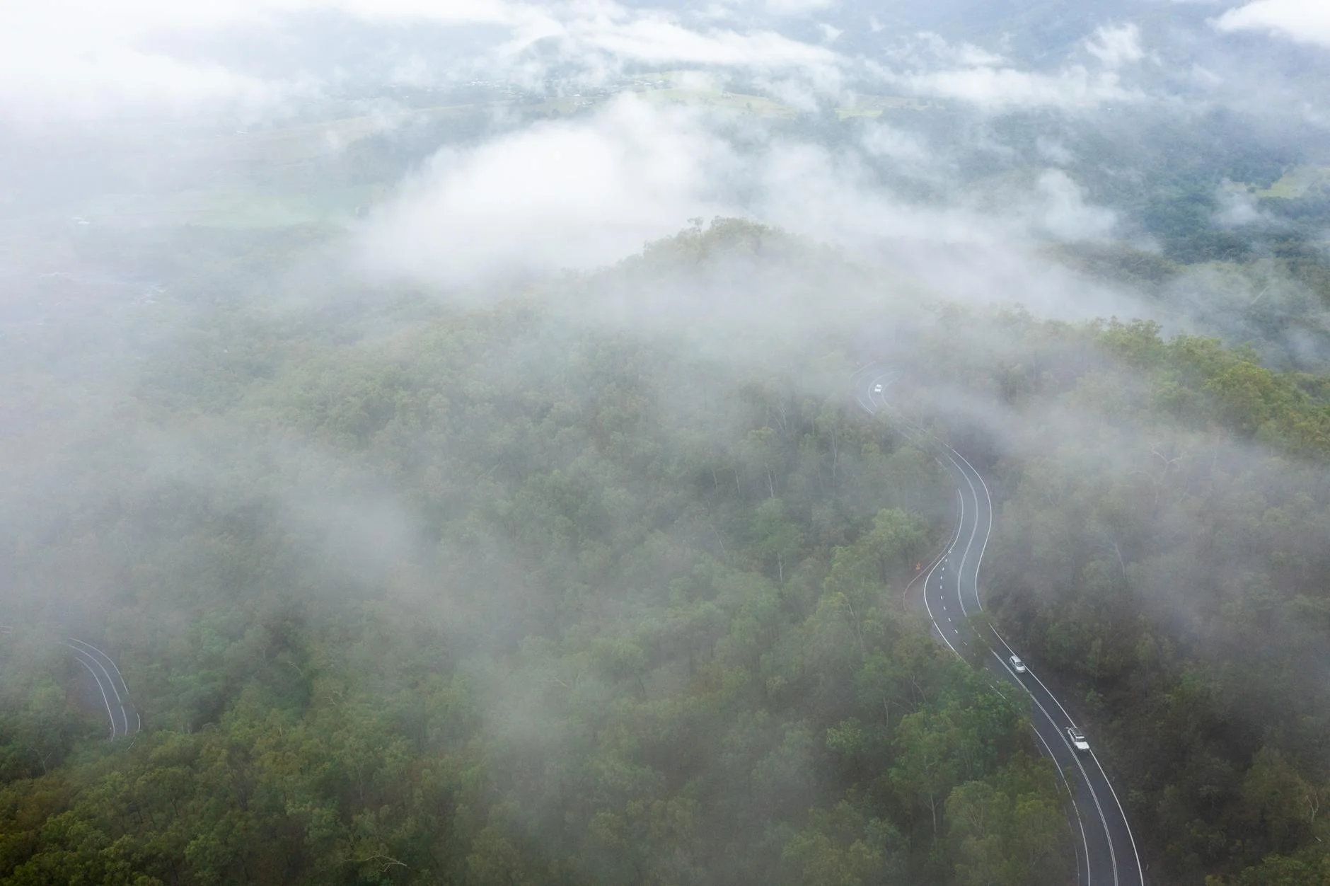
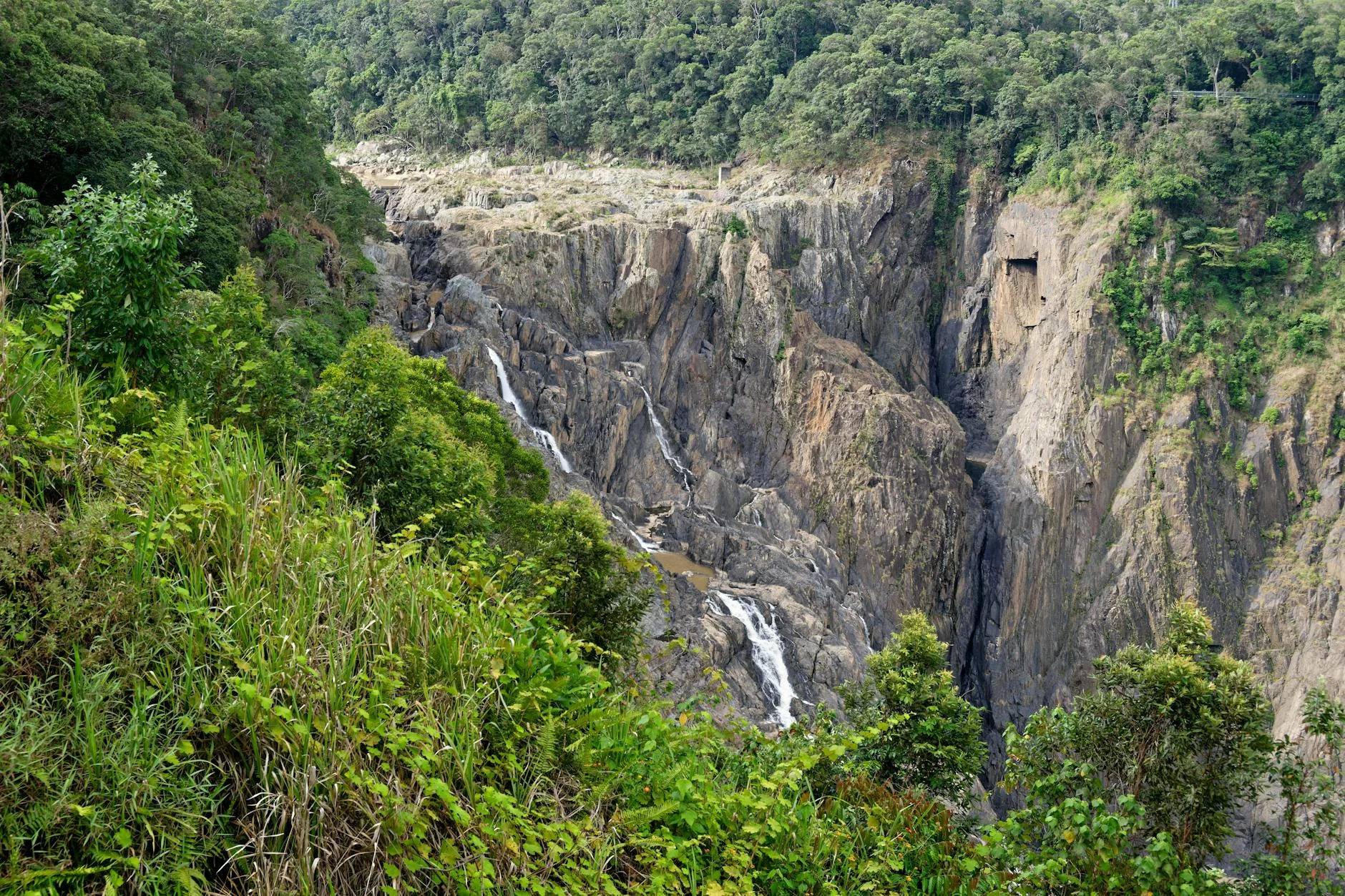
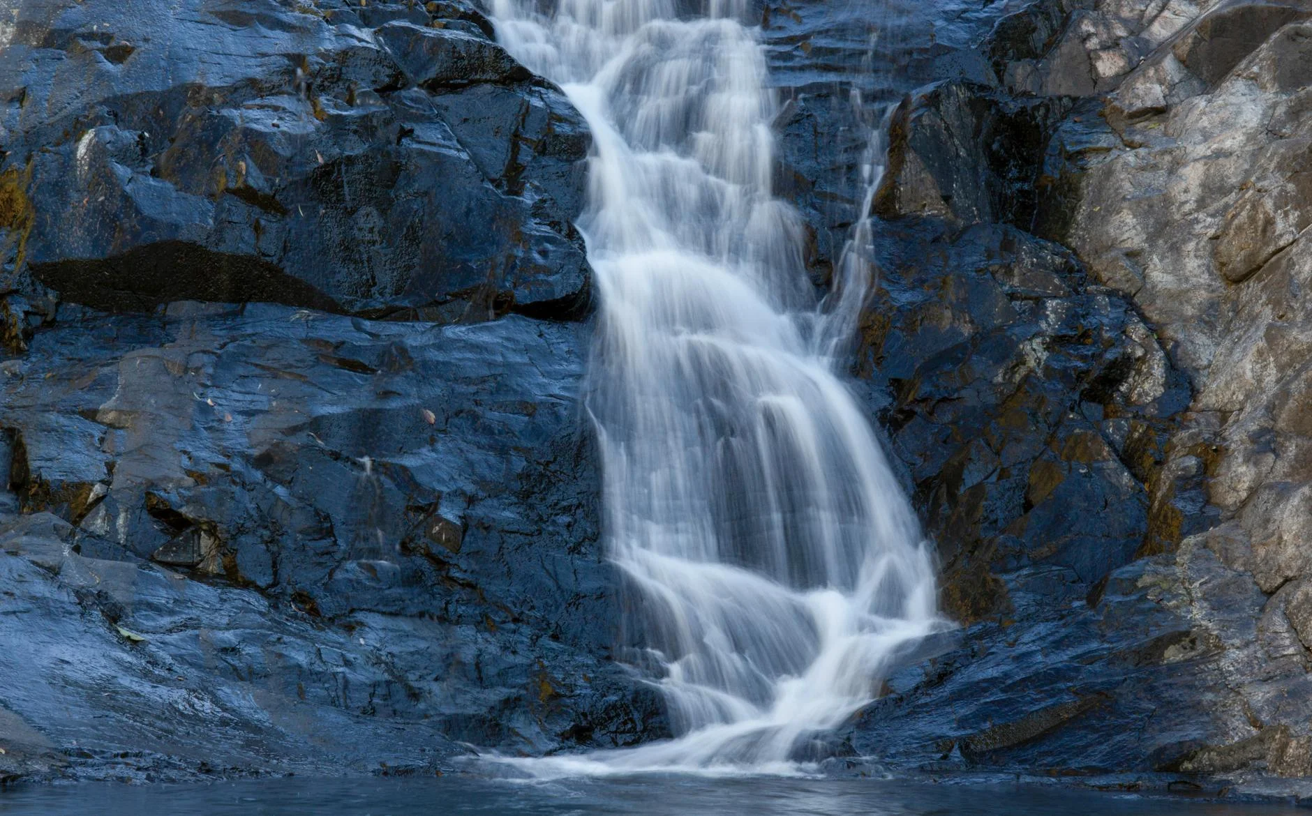
The best stage in the FNQ collection. The full Palmerston Highway runs 55 kilometres from Millaa Millaa on the Atherton Tablelands to Innisfail on the Cassowary Coast, dropping over 1,000 metres through World Heritage rainforest. The Targa Great Barrier Reef rally uses a 28.81 km competitive section of this road - the full drive is nearly twice as long and takes in the complete descent. The descent is constant and demanding. The road engineers had to fit a major altitude change into a narrow corridor and the result is a series of tight hairpins connected by steep straights that require braking discipline from top to bottom. The highest point of the highway reaches 1,050 metres; the lowest is near sea level at Innisfail. The rainforest closes completely overhead. There is no view until the road breaks out onto the coastal plain at the bottom, at which point the Coral Sea appears ahead and the full scale of the descent becomes apparent. Cassowaries cross the road in the lower section - they have right of way and will not move.
The best stage in the FNQ collection.
Why this road
The region
The Palmerston Highway connects the Atherton Tablelands to the Cassowary Coast via the Wet Tropics World Heritage Area. The rainforest through which it descends is among the oldest continuously existing rainforest in the world and contains species found nowhere else. The highway was built in the 1930s-1960s to provide a second access route to the tablelands beyond the Gillies Highway.
Before you go
Fuel in Millaa Millaa before descent or Innisfail at the base. Allow a full hour for the 55-kilometre drive. The wet season makes the descent significantly more demanding and the road can be closed after severe weather events.
See a routing error?
Flag itWorth stopping for
Innisfail Art Deco Architecture
Innisfail was rebuilt after a cyclone in 1918 and contains a notable concentration of Art Deco buildings.
Josephine Falls
Natural rock waterslide in the rainforest accessible from the Palmerston Highway - a short detour worth making.
Route
Start
Millaa Millaa
End
Innisfail
Gallery
More roads like this