Springbrook Road
27 km
distance
40 min
Contour time
8.1
avg score
Sealed
surface
Scenery
Queensland
Springbrook Road climbs the Springbrook Plateau from Mudgeeraba on the Gold Coast, rising 700 metres through...
Road quality
8.1 RQS
Strong. Above average on most quality signals.
Accessibility
Fully sealed
Best in Sports car. Peak season: Year-round.
7-day forecast
Sharp sealed hairpins up the Springbrook escarpment with consistent corner loading through the national park. Sports car handles this well - the surface is in good condition and the corners are tight enough to reward a skilled driver. Motorbike equally good. The canopy keeps sections damp year-round.
Scored 8.1/10 by Contour's road quality algorithm across curviness, surface, elevation and traffic. Best suited for sports car drivers.
The road
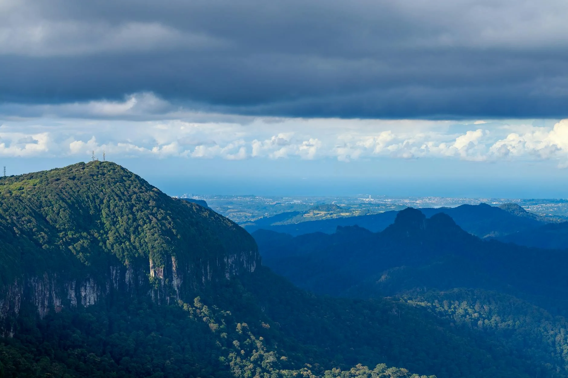
Springbrook Road climbs 700 metres from Mudgeeraba on the Gold Coast to the Springbrook Plateau on the rim of an ancient shield volcano. The 27-kilometre sealed road is a genuine escarpment climb through Springbrook National Park, with tight hairpins on the lower sections and a dense subtropical rainforest canopy for most of the ascent. The plateau at the top sits on the same volcanic rim as the Tweed Valley and Wollumbin on the NSW side. Several waterfalls cascade off the rim, including Purling Brook Falls which drops 109 metres. The Canyon lookout near the top gives views across the Tweed Valley and down to the Gold Coast skyline. This road is an anomaly - a serious mountain road 30 minutes from one of Australia's most developed coastal strips. The Natural Bridge rock arch, formed by a waterfall eroding through a lava cave, is accessible from a short walk and has glowworms visible at dusk. Most Gold Coast visitors never drive this road, which keeps the traffic manageable even on weekends.
Springbrook Road climbs 700 metres from Mudgeeraba on the Gold Coast to the Springbrook Plateau on the rim of an ancient shield volcano.
Why this road

The region
Springbrook Road climbs the Springbrook Plateau from Mudgeeraba on the Gold Coast, rising 700 metres through Springbrook National Park. The plateau sits on the rim of an ancient shield volcano - the same caldera that formed the Tweed Valley on the NSW side. Several waterfalls, including Purling Brook Falls, cascade off the plateau rim. The road is the main access to Springbrook village and the national park facilities.
Before you go
Fuel in Mudgeeraba before the climb. Road is sealed throughout and open year-round. The canopy keeps sections damp - allow for reduced grip. Weekend traffic is moderate as Springbrook is a popular Gold Coast day trip. Best driven early morning or on weekdays. The Canyon lookout near the top is worth stopping for - views over the Tweed Valley.
See a routing error?
Flag itWorth stopping for
Natural Bridge
A natural rock arch formed by a waterfall through a lava cave - accessible via a short walk just off the Springbrook road circuit. Glowworms visible in the cave at dusk.
Best of All Lookout
The highest point on the Springbrook Plateau with views stretching to the Gold Coast skyline on one side and the Tweed Valley and Wollumbin on the other.
Route
Start
Mudgeeraba
End
Springbrook
Gallery

More roads like this
