Oxley Highway
272 km
distance
3h 45m
Contour time
8.2
avg score
Sealed
surface
Scenery
New South Wales
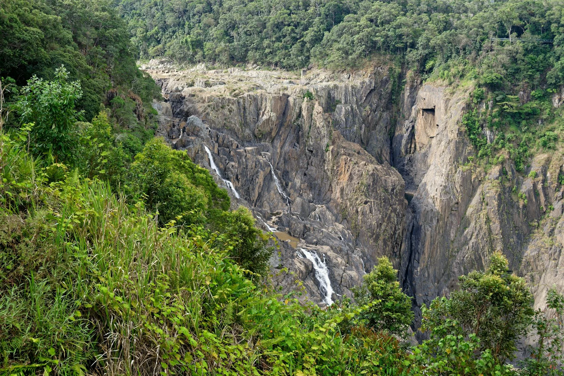
The Macleay Valley cuts west from the NSW north coast through increasingly remote country before the plateau edge. The...
Road quality
8.2 RQS
Strong. Above average on most quality signals.
Accessibility
Fully sealed
Best in Sports car. Peak season: Year-round.
7-day forecast
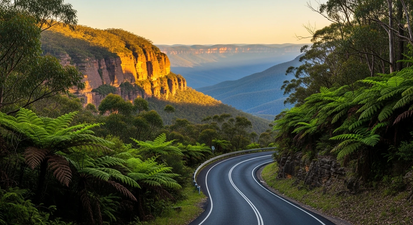
Mountain gorge highway with long sweeping bends and excellent sight lines. One of the best sealed mountain drives in NSW.
Scored 8.2/10 by Contour's road quality algorithm across curviness, surface, elevation and traffic. Best suited for sports car drivers.
The road
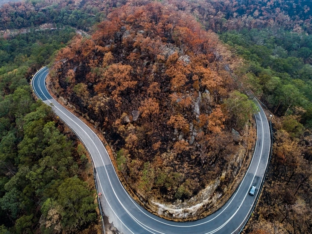
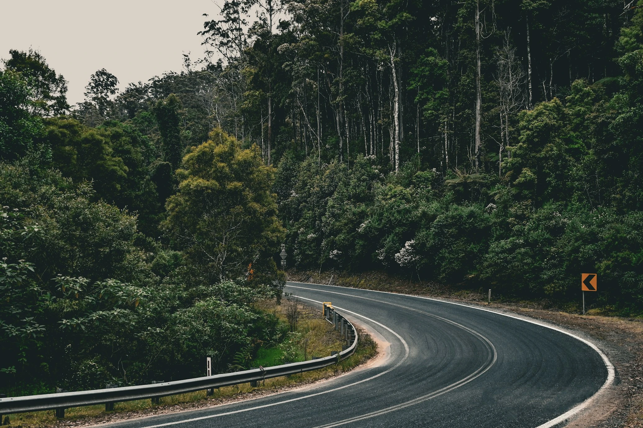
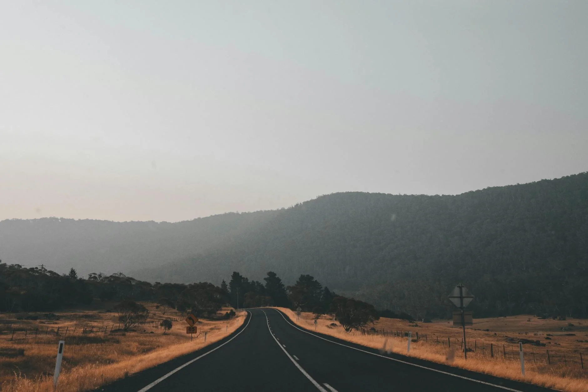
The Oxley Highway is one of Australia's genuinely great mountain highway drives. The 272-kilometre run from Port Macquarie on the coast to Tamworth on the New England plateau crosses the Great Dividing Range through the Macleay River gorge system and the Werrikimbe National Park wilderness. The gorge section is the heart of the drive - a 60-kilometre descent and climb through ancient rainforest, basalt columns, cliff faces and waterfalls that bear no resemblance to the flat coastal country at either end. The road is wide by Australian mountain standards, with good sight lines and consistent sweeping bends rather than tight switchbacks. This rewards pace and commitment rather than finesse. The surface is well-maintained and the few towns along the route are spaced far enough apart to feel remote without being isolating. Wauchope at the coastal end and Tamworth at the inland end are the overnight options. The drive is best done east to west - climbing from the coast into the gorge, with the views opening up progressively as you gain altitude.
The Oxley Highway is one of Australia's genuinely great mountain highway drives.
Why this road
The region
The Macleay Valley cuts west from the NSW north coast through increasingly remote country before the plateau edge. The Werrikimbe National Park in the gorge section is World Heritage listed as part of the Gondwana Rainforests of Australia and the vegetation transitions through subtropical rainforest, warm temperate rainforest, eucalypt forest and then the dry grassy woodland of the western slopes as the road approaches Tamworth. Tamworth itself is Australia's country music capital, with a January festival that brings 50,000 people to a town of 60,000.
Before you go
Fuel at Port Macquarie, Wauchope, Walcha and Tamworth. The gorge section has no fuel for 100-plus kilometres - fill up at Wauchope before the climb. The road is open year-round but can flood at creek crossings after heavy rain. Logging trucks use this road regularly in the forestry sections - give them room. Allow 3-4 hours end to end at a safe pace.
See a routing error?
Flag itWorth stopping for
Dooragan National Park
Coastal heath and lighthouse at Tacking Point, 10km from Port Macquarie, with excellent whale watching during the June-November migration.
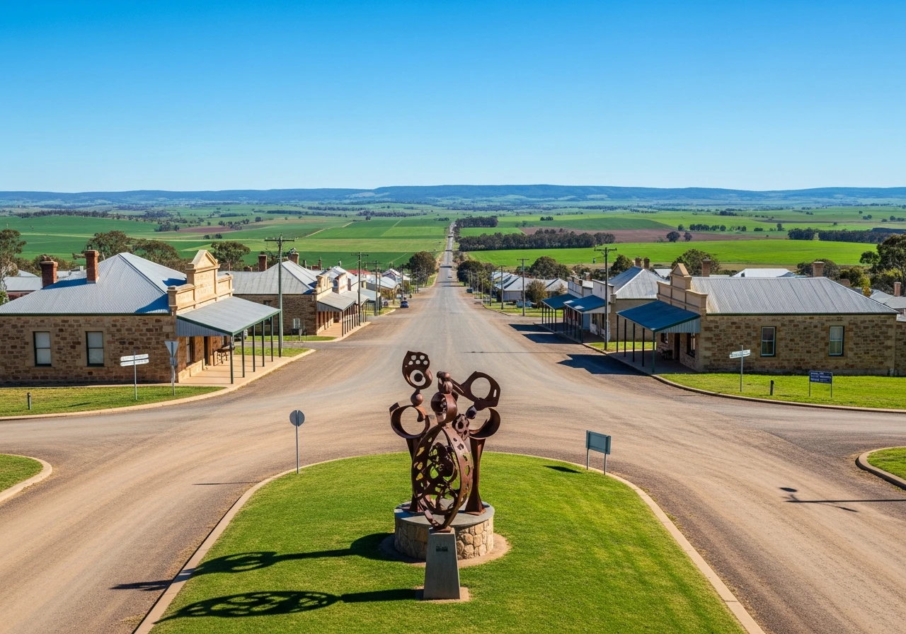
Walcha
A small plateau town halfway along the route with an unexpected gallery of large outdoor sculptures scattered through the streets and surrounding paddocks.
Route
Start
Port Macquarie
End
Tamworth
Gallery
More roads like this