Blue Mountains Drive
38 km
distance
45 min
Contour time
6.5
avg score
Sealed
surface
Scenery
New South Wales
The Blue Mountains is a high sandstone plateau 65 kilometres west of Sydney, cut by a network of deep canyons and...
Road quality
6.5 RQS
Every segment scored on 40+ data signals.
Accessibility
Fully sealed
Best in Sports car. Peak season: Year-round.
7-day forecast
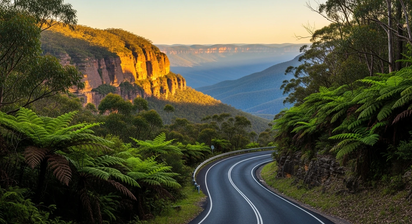
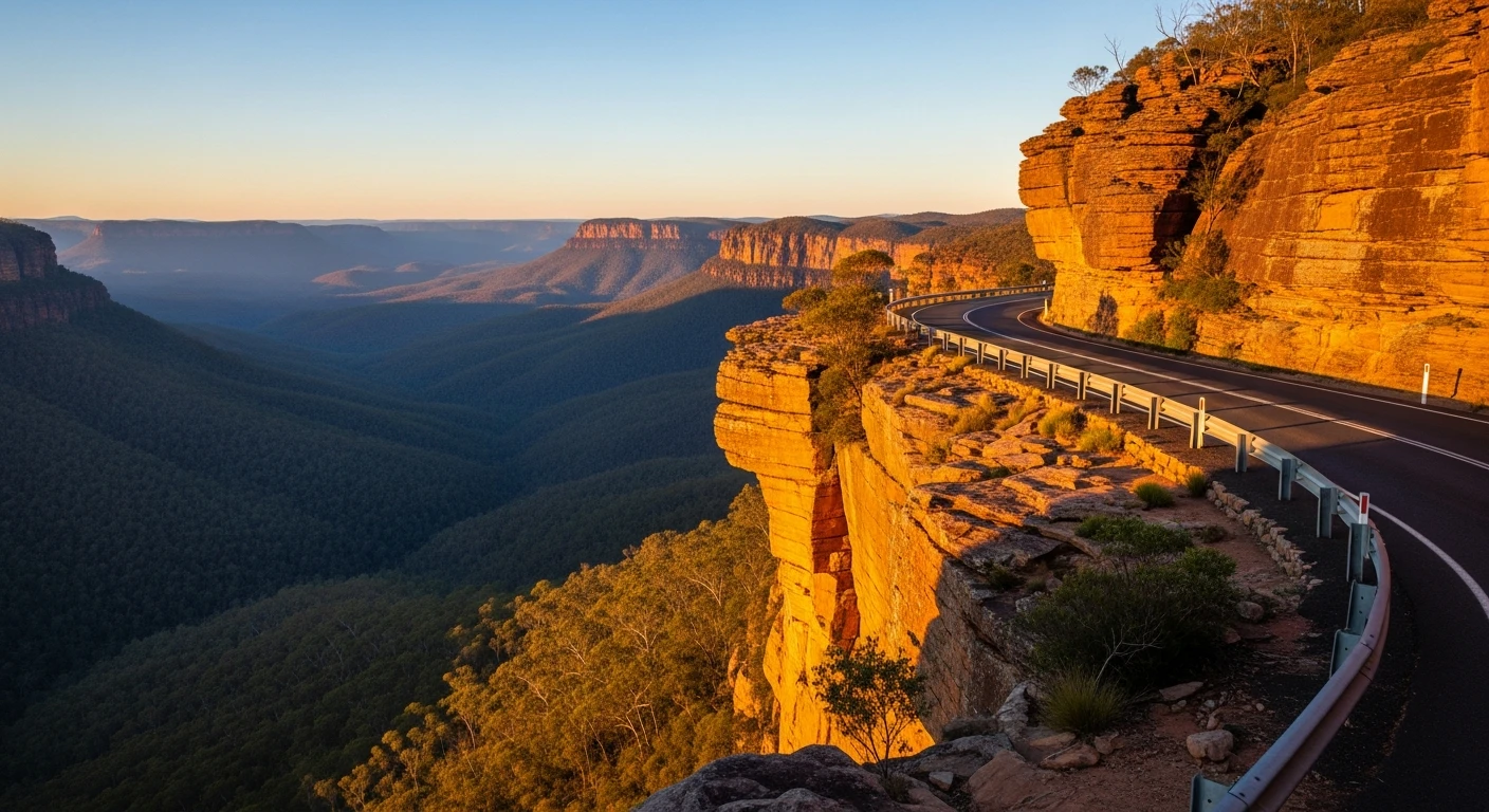
Cliff-edge sealed roads above the Jamison Valley with dramatic drops. Some of the best-looking driving near Sydney.
Scored 6.5/10 by Contour's road quality algorithm across curviness, surface, elevation and traffic. Best suited for sports car drivers.
The road
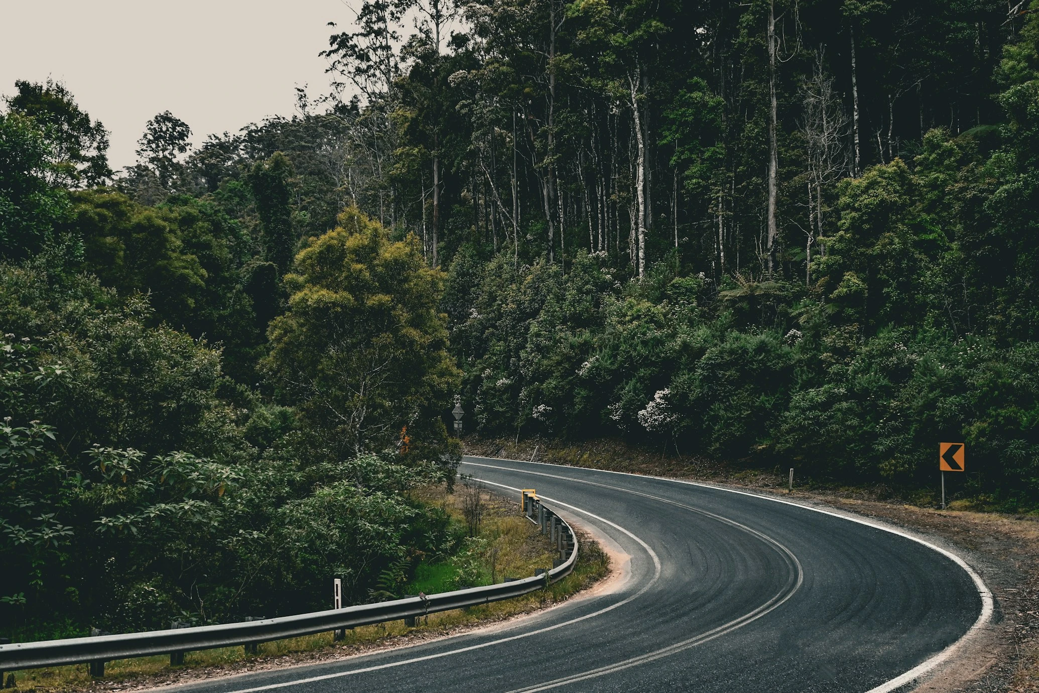
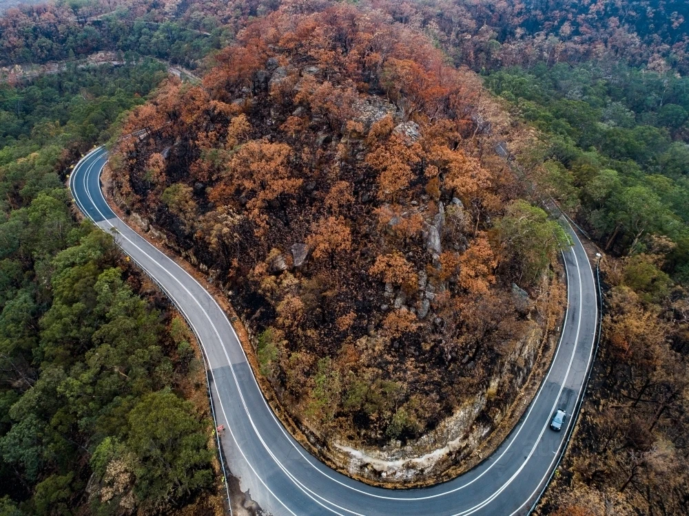
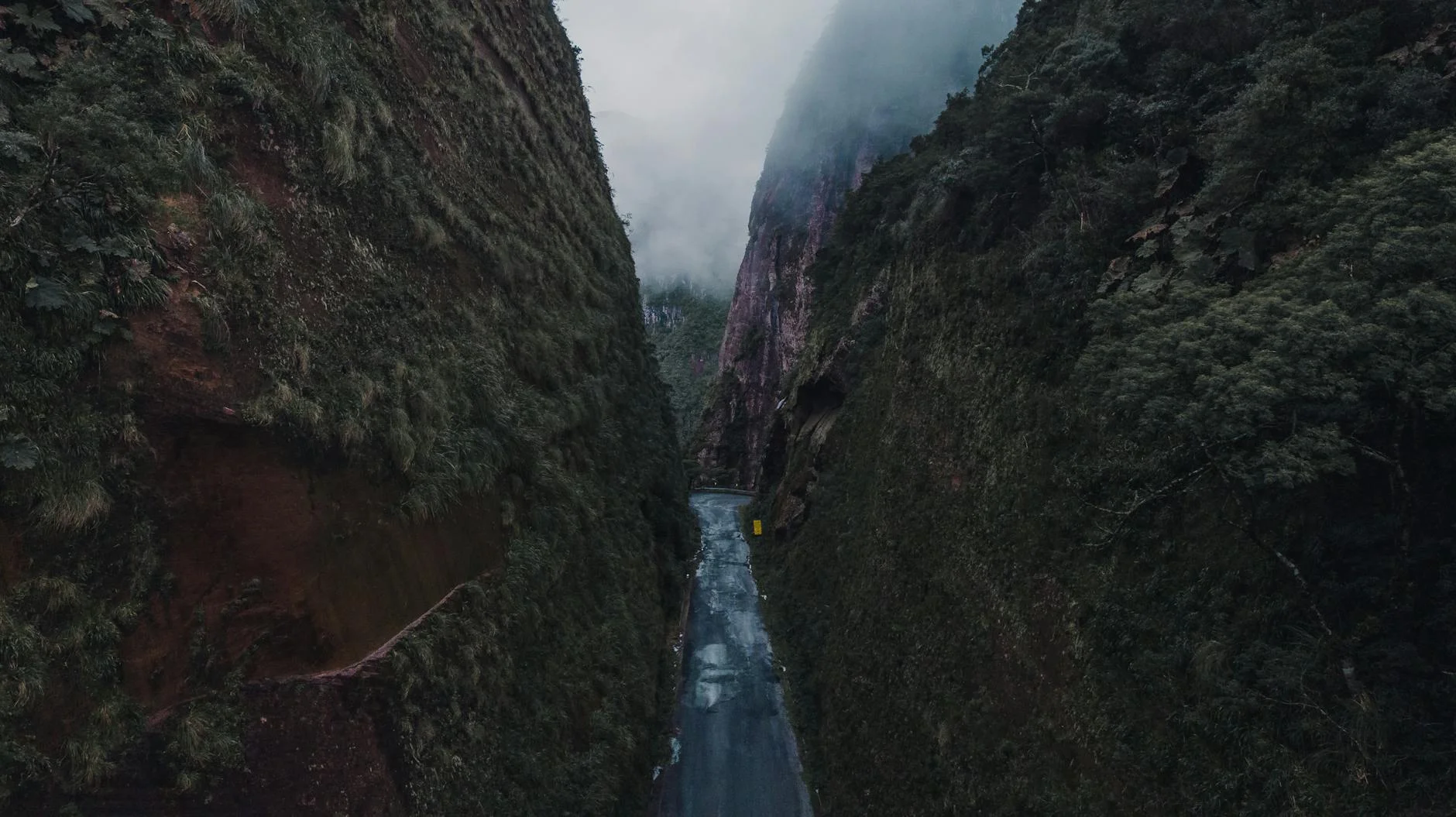
The Blue Mountains plateau road from Katoomba to Lithgow follows the rim of the Jamison Valley with near-constant views into the sandstone canyon system below. The cliff-edge sections are the draw - the road runs within metres of 300-metre drops at several points, with the valley floor visible through the guardrails and the haze-softened sandstone formations visible across the canyon. The Great Western Highway carries the tourist traffic; the cliff road on the valley edge carries almost none. The route switches between the plateau rim and the forested back sections, with the rim sections rewarding slow speed and the bush sections rewarding pace. Katoomba is full of good cafes and tourist infrastructure. The road to Lithgow drops from the plateau at the western edge of the range through a serious descent - the Lithgow zigzag section was one of Australia's great engineering challenges in the railway era, and the road follows a similar alignment. The visibility into the valley on the approach to Lithgow is unlike anything on the eastern side.
The Blue Mountains plateau road from Katoomba to Lithgow follows the rim of the Jamison Valley with near-constant views into the sandstone canyon system below.
Why this road
The region
The Blue Mountains is a high sandstone plateau 65 kilometres west of Sydney, cut by a network of deep canyons and covered in dense eucalypt woodland. The mountains are actually a plateau - the 'mountains' are the canyon walls - and the roads run along the rim rather than through the valleys. The area receives significant rain from the coast and the permanent morning haze that gives the range its name comes from the eucalyptus oils evaporating from the forest canopy. The national park covers most of the plateau and canyon country.
History
The first European crossing of the Blue Mountains was achieved by Blaxland, Wentworth and Lawson in 1813, opening the western plains of New South Wales to settlement. The route they followed along the ridgelines rather than through the canyons is now the approximate line of the Great Western Highway.
Before you go
Fuel throughout - Katoomba, Blackheath and Lithgow. The cliff-edge sections carry significant tourist traffic on weekends. Weekday mornings are best. The descent to Lithgow is long and steep - use engine braking and monitor brake temperature. Train access from Sydney to Katoomba is excellent if you want to drive the road one-way.
See a routing error?
Flag itWorth stopping for
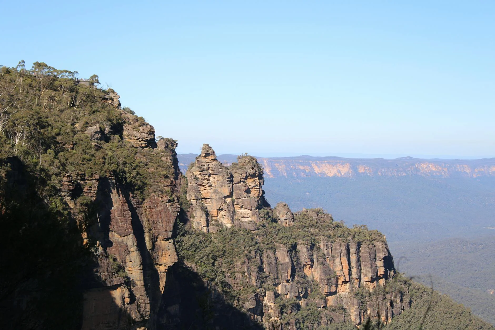
Three Sisters, Katoomba
The iconic sandstone formation at Echo Point, 5 minutes from Katoomba town centre - worth a walk to the lookout at dawn before the tour groups arrive.
Jenolan Caves
Australia's most visited cave system, 60km south of Katoomba via a famously narrow road through the valley - an excellent extension to the mountains day.
Route
Start
Katoomba
End
Lithgow
Gallery
More roads like this