Namadgi Alpine Drive
23 km
distance
30 min
Contour time
7.2
avg score
Sealed
surface
Scenery
ACT
The Australian Capital Territory covers 2,358 square kilometres, of which over half is either Namadgi National Park or...
Road quality
7.2 RQS
Strong. Above average on most quality signals.
Accessibility
Fully sealed
Best in Sports car. Peak season: Year-round.
7-day forecast
Better sealed road than most people expect from the ACT. Grassland plateau views and very little traffic.
Scored 7.2/10 by Contour's road quality algorithm across curviness, surface, elevation and traffic. Best suited for sports car drivers.
The road
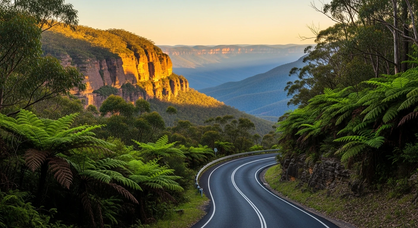
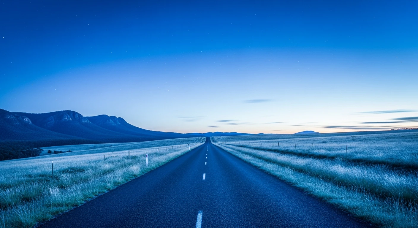
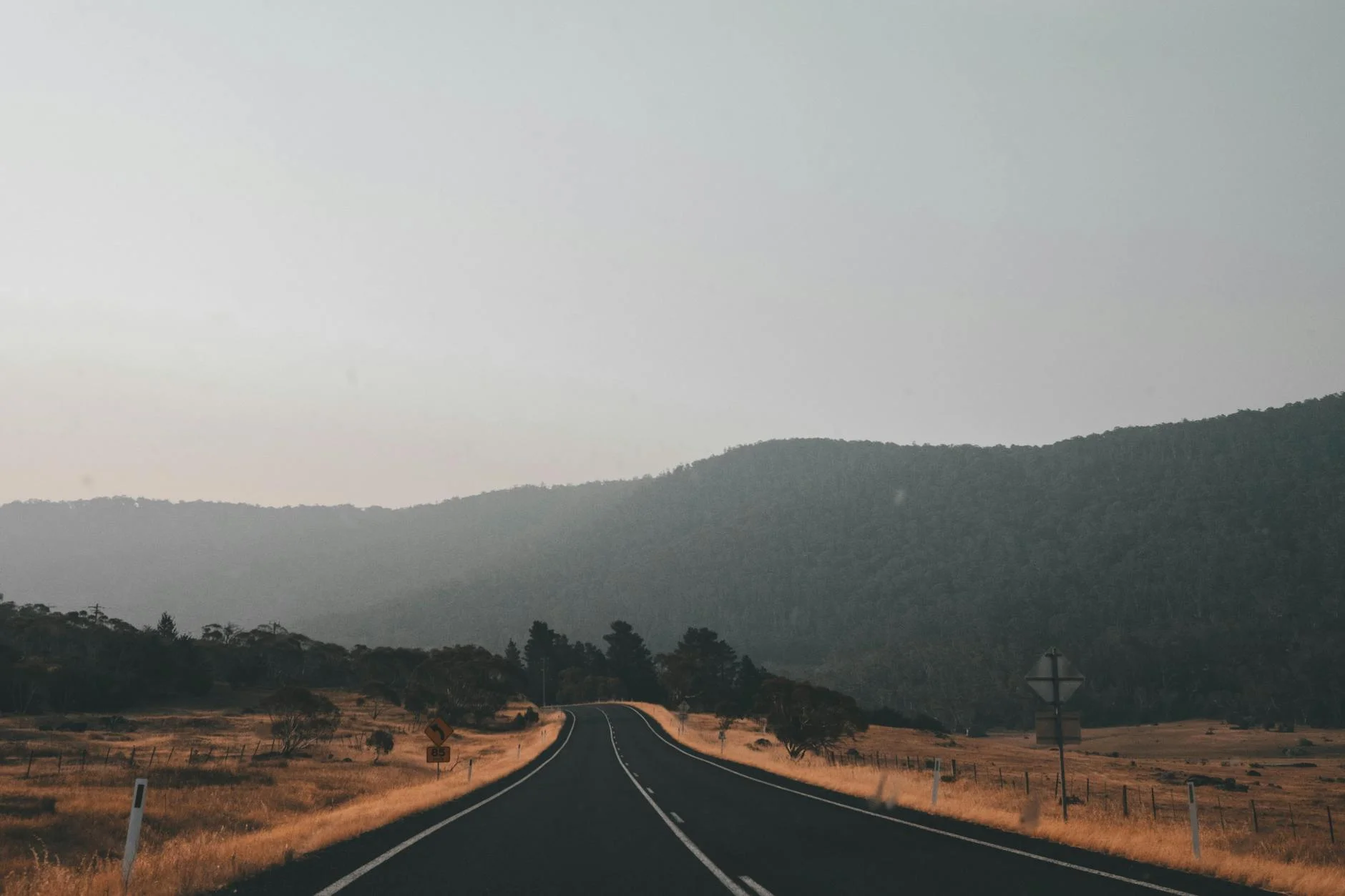
The Namadgi Alpine Drive from Tharwa to the Namadgi Visitor Centre is the road that demonstrates Canberra's underappreciated driving country. The 23-kilometre sealed route climbs from the Murrumbidgee River at Tharwa through the forested foothills of the Australian Capital Territory into Namadgi National Park, which covers 46 per cent of the ACT and is genuine subalpine wilderness. The road quality through this section is better than the surroundings suggest - it is maintained for park access and carries very little traffic. The grassland plateau sections above the treeline have a wide, open quality unusual for roads this close to a capital city. The Murrumbidgee River is visible on the approach from Tharwa, and the valley it occupies gives the lower section a different character to the plateau above. The Namadgi Visitor Centre at the end of the route is the gateway to a network of walking tracks and the Orroral Valley Radio Observatory, which operated as a NASA tracking station from 1965 to 1985.
The Namadgi Alpine Drive from Tharwa to the Namadgi Visitor Centre is the road that demonstrates Canberra's underappreciated driving country.
Why this road
The region
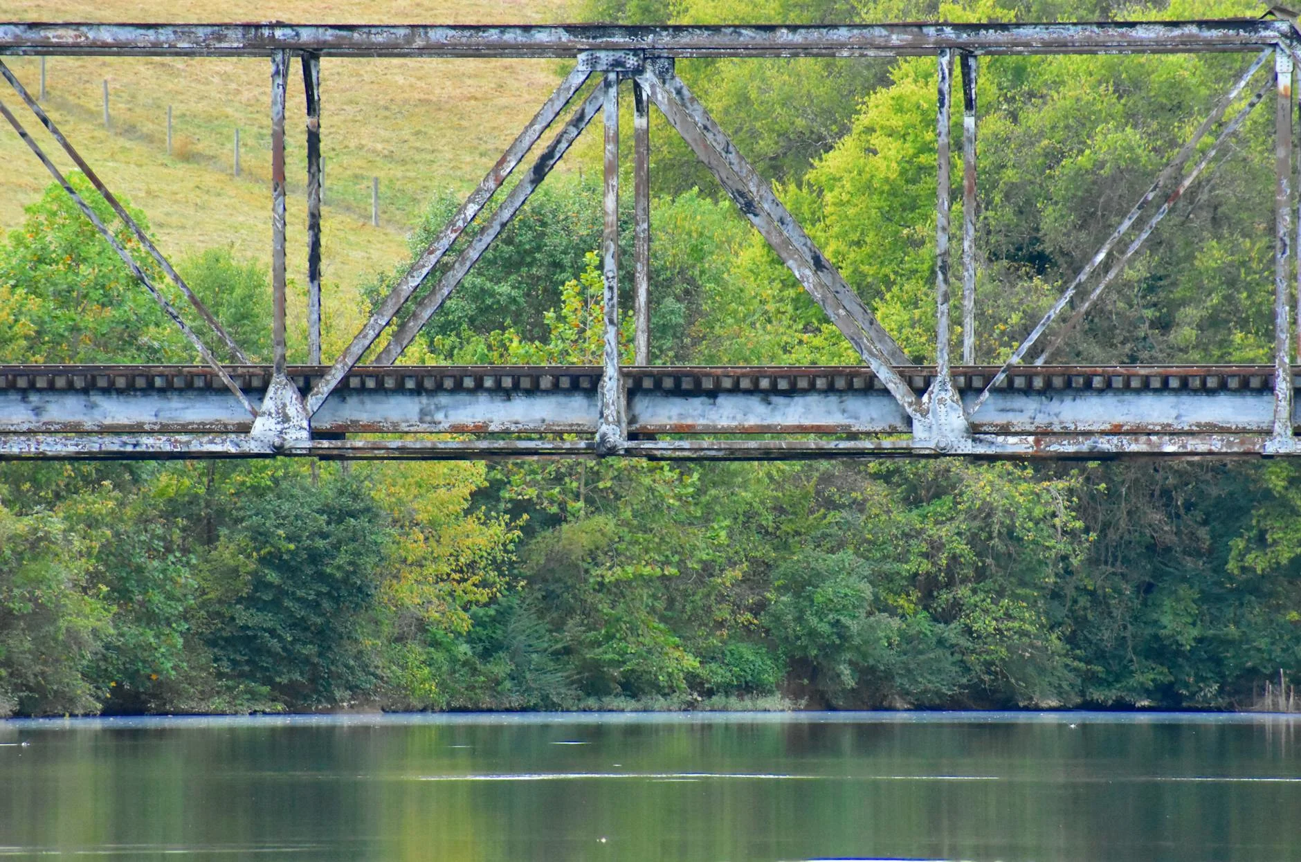
The Australian Capital Territory covers 2,358 square kilometres, of which over half is either Namadgi National Park or nature reserve. The national park is part of the Australian Alps system and contains the headwaters of the Cotter River. The subalpine grasslands at higher elevations are some of the few remaining examples of this habitat type in Australia. Tharwa is a small settlement on the southern edge of the ACT known for its heritage bridge - one of the oldest surviving iron truss bridges in Australia.

History
Namadgi National Park incorporates former grazing land leased by European settlers from the 1830s. Aboriginal occupation of the area dates back at least 25,000 years - the name Namadgi comes from the Ngunnawal word for the mountains south-west of Canberra.
Before you go
Fuel at Tharwa (general store, limited hours) or Canberra before departure. The road is open year-round but can have black ice in winter above 1,000 metres. Very light traffic throughout. Kangaroos and wombats are common on the road - drive carefully at dawn and dusk. The Namadgi Visitor Centre is open daily and has good information on walking tracks.
See a routing error?
Flag itWorth stopping for
Orroral Valley Radio Observatory
The former NASA Minitrack tracking station used during Apollo moon missions, accessible on a short walk from the Namadgi Visitor Centre - unusual history in an unlikely location.
Tharwa historic bridge
An 1895 iron truss bridge over the Murrumbidgee River, one of the oldest surviving bridges in the ACT and worth a short stop at the start of the drive.
Route
Start
Tharwa
End
Orroral Valley
Gallery
More roads like this