Lyell Highway
260 km
distance
3h 25m
Contour time
8.6
avg score
Sealed
surface
1050m
max elevation
+820m
total climb
Scenery
1050m elevation
Tasmania's west coast receives up to 3,000mm of rain annually and the vegetation through the western sections of this...
Road quality
8.6 RQS
Exceptional. Consistently high curviness, surface, and low traffic.
Accessibility
Fully sealed
Best in Sports car. Peak season: Summer-Autumn.
7-day forecast
Dramatic elevation changes across Tasmania's wild interior. Some of the best sealed mountain driving in the country. Can be wet in winter.
Scored 8.6/10 by Contour's road quality algorithm across curviness, surface, elevation and traffic. Best suited for sports car drivers.
The road
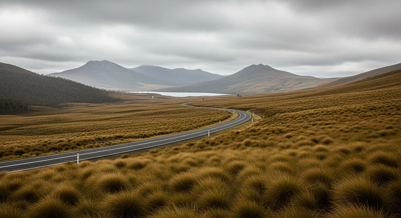
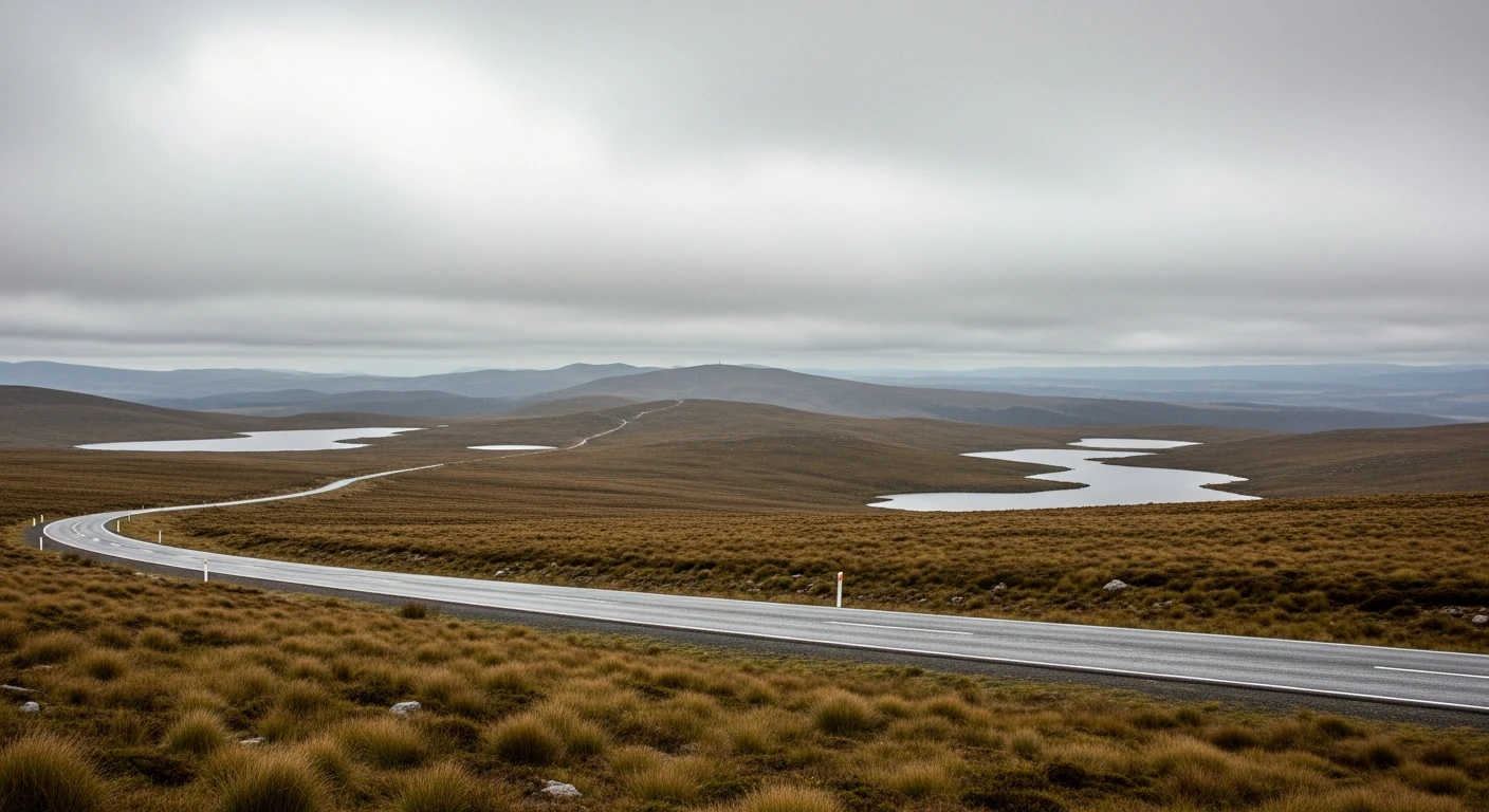
The Lyell Highway from Hobart to Queenstown is Tasmania's great cross-island drive and one of the most dramatic sealed road journeys in Australia. The 260-kilometre route crosses the Central Plateau through button grass plains and glacial tarns, descends into the rainforest-covered western mountains and then drops into the moonscape of the Queenstown mine site in a series of tight switchbacks with no barriers and long drops. The road from Lake St Clair west is the heart of it. The descent from the Franklin-Gordon Wild Rivers National Park into Queenstown is unlike anything else in the country - the vegetation disappears completely where historic copper smelter pollution has stripped the hillside bare, and the road winds down through coloured rock into a working mining town that feels genuinely remote. Driving back east in the afternoon the alpine sections of the Central Plateau are extraordinary - glacial lakes, treeless moorland and the feeling of genuine isolation that is hard to find on any sealed road.
The Lyell Highway from Hobart to Queenstown is Tasmania's great cross-island drive and one of the most dramatic sealed road journeys in Australia.
Why this road
The region
Tasmania's west coast receives up to 3,000mm of rain annually and the vegetation through the western sections of this drive reflects it - Huon pine, leatherwood and horizontal scrub form an almost impenetrable forest. The Central Plateau to the east of the main range is geologically very different - a flat, lake-dotted tableland formed by glacier action and now treeless above 900 metres. Queenstown is the endpoint: a copper mining town since 1883 with a character shaped entirely by its industrial history and its isolation.
History
The Lyell Highway is named after Charles Lyell, the Scottish geologist. It follows the route of the original pack horse trail used to supply the copper mining operations at Queenstown from the 1880s. The railway that ran parallel until 1963 was one of the most technically challenging railway operations in the southern hemisphere.
Before you go
Fuel at Hobart, New Norfolk, Hamilton, and Queenstown. The route is 260 km - fill at Hobart for the western section. The road is open year-round but the western mountain section can be closed by snow or ice between June and September. Check conditions with the TasRoads website before departing in winter. The descent into Queenstown requires careful brake management.
See a routing error?
Flag itWorth stopping for
Lake St Clair
Australia's deepest lake and the southern terminus of the Overland Track, with walking trails into old-growth myrtle forest accessible from the highway junction.
Queenstown copper mines
The coloured bare hillsides around Queenstown are the result of 130 years of copper smelting that stripped the vegetation - a strange and genuinely striking landscape to walk around.
Route
Start
Hobart
End
Queenstown
More roads like this