Jim Jim Falls Track
100 km
distance
3h
Contour time
6.5
avg score
Unsealed
surface
Scenery
Northern Territory
Kakadu National Park covers 20,000 square kilometres of the Top End. It is simultaneously a National Park, a World...
Road quality
6.5 RQS
Every segment scored on 40+ data signals.
Accessibility
Fully sealed
Best in 4WD. Peak season: May-October.
7-day forecast
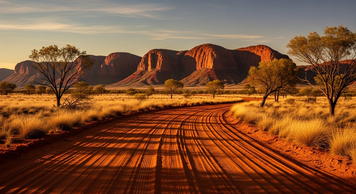
Rocky corrugated track with creek crossings. High clearance essential - the creek crossings have rocky beds and the corrugations are severe in mid-season. 4WD low-range required for the rocky sections near the falls car park.
Scored 6.5/10 by Contour's road quality algorithm across curviness, surface, elevation and traffic. Best suited for 4wd drivers.
The road
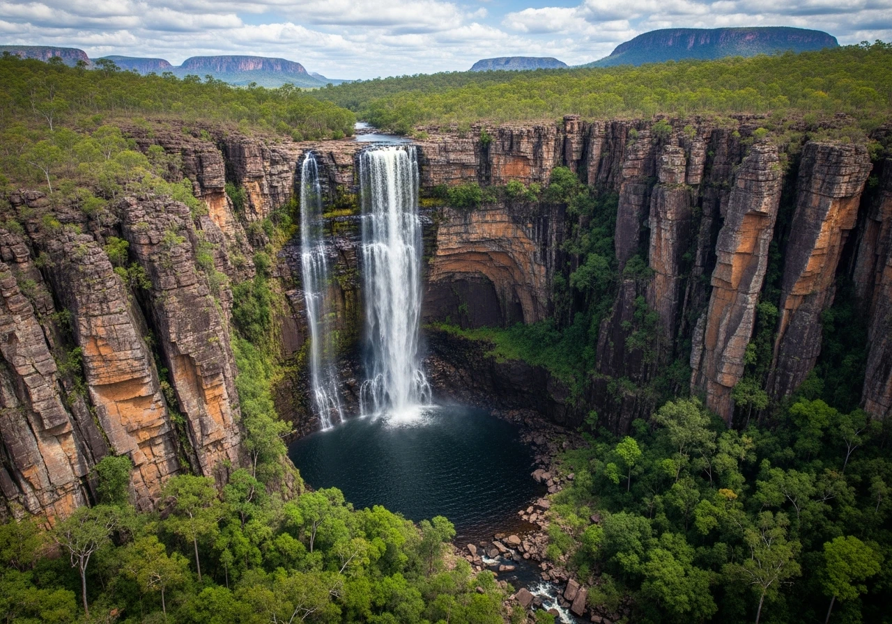
Jim Jim Falls is one of the most dramatic waterfalls in Australia - a 200-metre vertical drop of the Jim Jim Creek off the Arnhem Land escarpment into a plunge pool at the base. In the wet season the falls run at full force and are completely inaccessible. In the dry season they reduce to a thin ribbon or stop entirely, but the plunge pool at the base remains full from the wet season flow and the gorge is accessible by 4WD and then a 1.5km walk through boulders. The 60km access track from the Kakadu Highway is rocky, corrugated and requires commitment - it is not a track to attempt without preparation. The reward is a World Heritage landscape with minimal visitors: the rock pools, the monsoon forest in the gorge drainage and the escarpment above are genuinely remote-feeling despite being in one of Australia's most visited national parks.
Jim Jim Falls is one of the most dramatic waterfalls in Australia - a 200-metre vertical drop of the Jim Jim Creek off the Arnhem Land escarpment into a plunge pool at the base.
Why this road
The region
Kakadu National Park covers 20,000 square kilometres of the Top End. It is simultaneously a National Park, a World Heritage Area and Aboriginal land - the traditional owners lease the land to the Commonwealth for joint management. The Bininj and Mungguy people have occupied this country for more than 65,000 years. The park has one of the world's densest concentrations of Aboriginal rock art.

Before you go
The Jim Jim Falls access track is open May to October only - the wet season floods the track. Park fees apply on entry. Carry plenty of water. The final section near the falls car park is the most technical - rock steps and narrow sections. Vehicle width greater than 2m will struggle. Allow a full day from Jabiru return. Saltwater crocodiles are present in all waterways in Kakadu. The Jim Jim plunge pool is surveyed and trapped by rangers before each dry season opening, but Twin Falls requires a short boat crossing specifically because crocodiles inhabit the water between the walking track and the falls.
See a routing error?
Flag itWorth stopping for
Twin Falls Gorge
A further 20km from Jim Jim on an equally rocky track - a wider gorge with two separate waterfall streams and a long sandy beach at the base.
Nourlangie Rock
The most visited rock art site in Kakadu - accessible from the sealed road and worth spending a morning with the interpretive panels.
Gunlom Falls (UDP Falls)
A separate 4WD-accessible waterfall in Kakadu's south, 37 km off the sealed Stuart Highway. Famous as the Crocodile Dundee waterfall. The walk to the top rewards with a natural infinity pool overlooking the southern hills of Kakadu - one of the best swimming spots in the Top End.
Route
Start
Jabiru
End
Jim Jim Falls
Gallery

More roads like this