Expedition National Park (Robinson Gorge)
50 km
distance
3h
Contour time
2.4
avg score
Unsealed
surface
Scenery
Queensland
Central Queensland between Biloela and Injune is grazing and mining country - flat to undulating ironbark woodland with...
Road quality
2.4 RQS
Every segment scored on 40+ data signals.
Accessibility
Fully sealed
Best in 4WD. Peak season: April-October.
7-day forecast
Graded unsealed road for most of the approach with some rougher sections near the gorge. The final descent to the camping area has loose rock and requires high clearance. Not technically hard but remote - a breakdown would be inconvenient and expensive.
Scored 2.4/10 by Contour's road quality algorithm across curviness, surface, elevation and traffic. Best suited for 4wd drivers.
The road
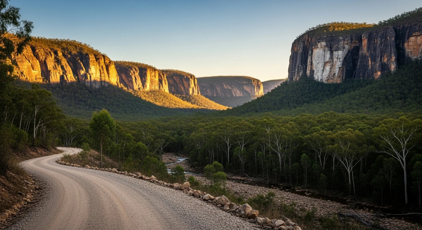
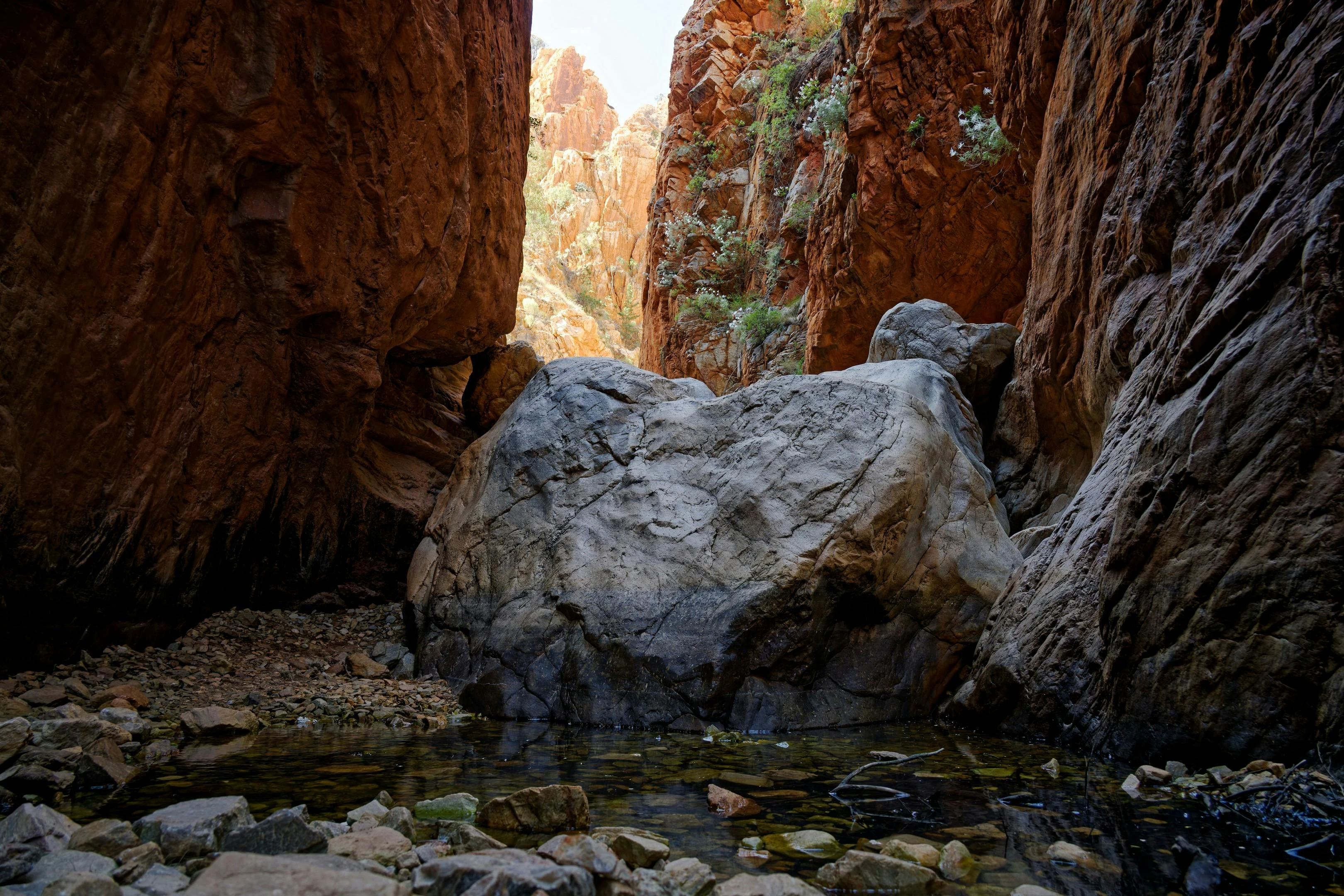
Expedition National Park is named after Ludwig Leichhardt's 1844 expedition through central Queensland, and the country around Robinson Gorge has changed almost nothing since he passed through. The 50-kilometre unsealed road from the Glenhaughton Road turnoff leads to a sandstone gorge system that rivals Carnarvon Gorge for beauty but receives a fraction of the visitors. Robinson Gorge is a 30-metre-deep sandstone gorge cut by Robinson Creek through the Dawson Range. The walls are layered cream and ochre sandstone with overhangs, alcoves and Aboriginal art sites. The walking track along the gorge floor follows the creek past permanent waterholes, palm-filled side gorges and sandstone formations eroded into arches and pillars. The approach road passes through typical central Queensland grazing country - open ironbark woodland, dry grass, cattle grids. There is nothing to suggest you are approaching a significant landscape feature until the road drops over the range edge and the gorge appears below. The campground sits on the rim above the gorge with views down into the creek system. It has basic facilities - pit toilets, fire rings, rainwater tank (when functional). The isolation is extreme. On most weekdays there are zero other visitors. During Queensland school holidays you might share the campground with two or three other groups. The gorge walk takes 3-4 hours return and is the main activity. The rock art sites along the gorge are not signed or fenced - they are where they have always been.
Expedition National Park is named after Ludwig Leichhardt's 1844 expedition through central Queensland, and the country around Robinson Gorge has changed almost nothing since he passed through.
Why this road
The region
Central Queensland between Biloela and Injune is grazing and mining country - flat to undulating ironbark woodland with small towns at intervals along the highway. The Dawson Range runs through the middle of this country and the gorge systems cut into it are its best feature. Expedition National Park covers two separate sections - Robinson Gorge in the north and Lonesome in the south. The nearest sizeable town is Taroom, 80 kilometres to the southeast, with fuel, a pub and basic supplies.

Before you go
Fuel at Taroom or Biloela. No fuel or services between the highway and the gorge. Carry all water and food. The rainwater tank at the campground is unreliable. The road is impassable after heavy rain - the clay sections become extremely slippery. Check road conditions with Queensland Parks. Bush camping only - self-registration at the campground. No mobile coverage. Allow a full day minimum - most people camp overnight. The nearest hospital is Biloela, 2 hours by road. Summer temperatures in the gorge exceed 40 degrees.
See a routing error?
Flag itWorth stopping for
Isla Gorge National Park
A smaller sandstone gorge system 60km north, accessible from the Dawson Highway. Worth a half-day detour on the way to or from Robinson Gorge.
Taroom pub
The Leichhardt Hotel in Taroom is a classic Queensland country pub - cold beer and a steak after a dusty day on the track.
Route
Start
Dawson Highway turnoff
End
Robinson Gorge
Gallery

More roads like this