Carnarvon Gorge
95 km
distance
2h 30m
Contour time
4.2
avg score
Unsealed
surface
Scenery
Queensland
The Carnarvon Ranges rise above the Central Queensland coalfields and contrast dramatically with the surrounding flat...
Road quality
4.2 RQS
Every segment scored on 40+ data signals.
Accessibility
Fully sealed
Best in 4WD. Peak season: April-October.
7-day forecast
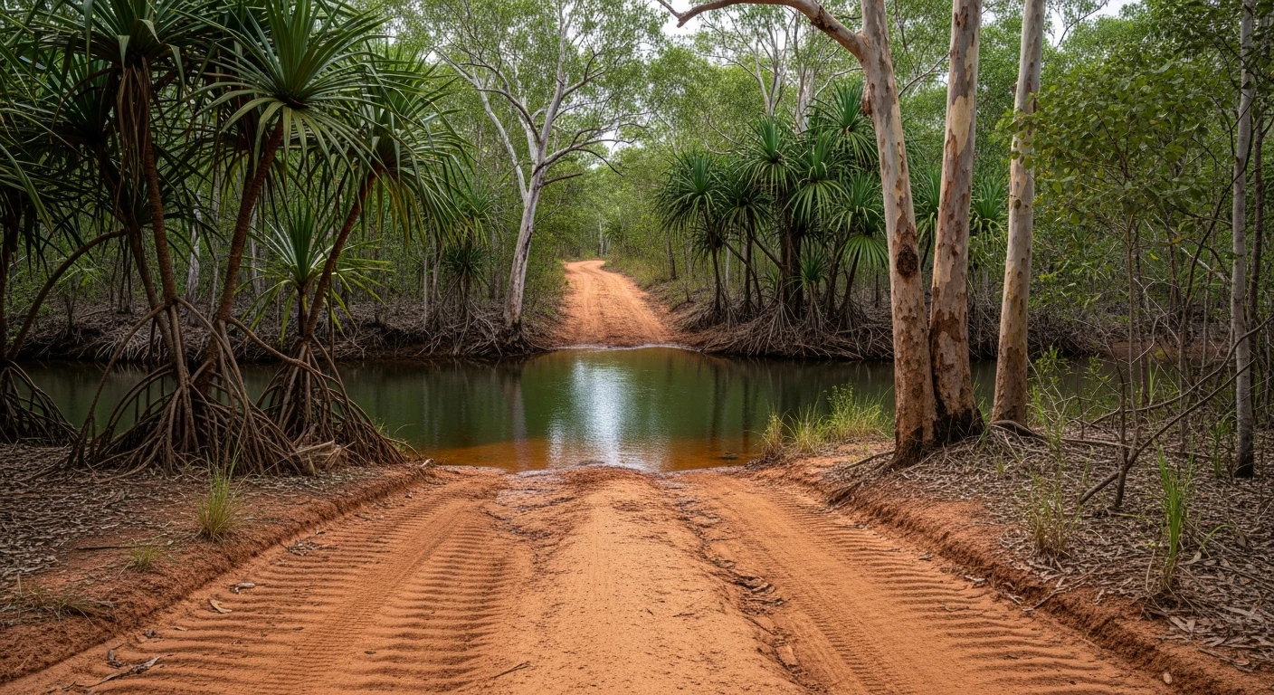
Unsealed red dirt road with some corrugations and rocky sections. Two-wheel-drive vehicles attempt this regularly but high clearance and 4WD traction are strongly recommended, especially after rain when the creek crossings become impassable for low vehicles.
Scored 4.2/10 by Contour's road quality algorithm across curviness, surface, elevation and traffic. Best suited for 4wd drivers.
The road
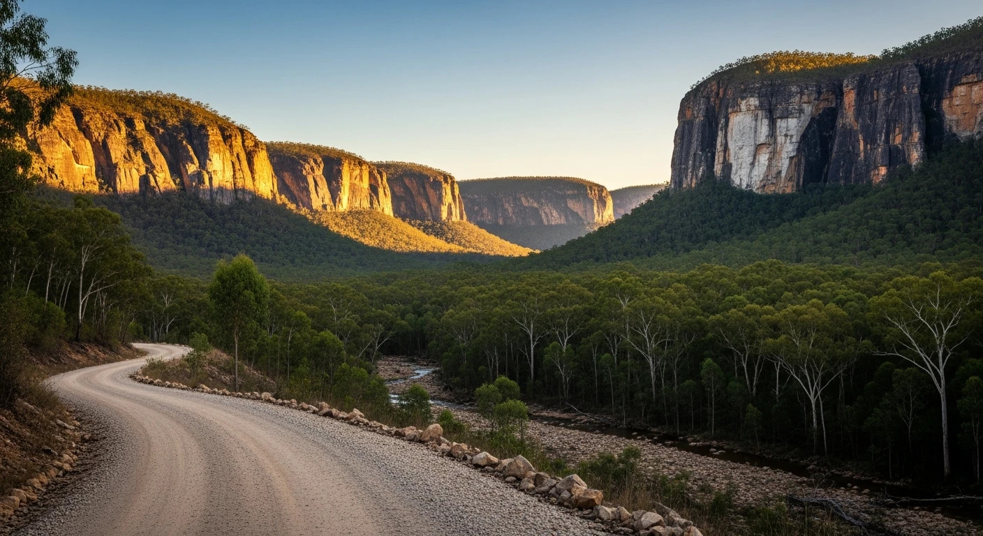
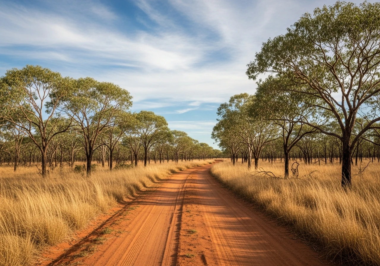
Carnarvon Gorge is a 200-metre-deep sandstone gorge cut by Carnarvon Creek through the sandstone plateau of central Queensland. The 95-kilometre unsealed approach road from Rolleston is the first half of the experience. The road crosses the Brigalow Belt - a semi-arid open woodland that was once Australia's most extensive brigalow scrub, now largely cleared, with the remnant patches visible in the national park boundary country. The creek crossings on the approach are shallow in the dry season but rise fast after rain. The gorge itself is the destination - 12 kilometres of walking track follows the creek upstream past Aboriginal art sites, moss gardens, cycad palms and sheer white sandstone walls. The art at Art Gallery and Cathedral Cave is significant - stencilled hands, animal tracks and sacred symbols accumulated over thousands of years. The gorge floor stays cool even in the summer heat. The most recent time anyone drove the last few kilometres to the visitor centre was decades ago - the park access is 2WD-accessible from Springsure via the shorter sealed approach, but the Rolleston run is the 4WD approach that puts you in the right headspace.
Carnarvon Gorge is a 200-metre-deep sandstone gorge cut by Carnarvon Creek through the sandstone plateau of central Queensland.
Why this road
The region
The Carnarvon Ranges rise above the Central Queensland coalfields and contrast dramatically with the surrounding flat grazing country. Rolleston is a small rail and grazing town that serves as the southern gateway. The town has a pub, basic supplies and accommodation. Carnarvon Gorge National Park has a campground at the visitor centre - bookings essential in school holidays. The park is in the Maranoa-Balonne-Condamine water catchment.

Before you go
Fuel in Rolleston. Last reliable fuel before the gorge. The approach road has no facilities. After rain the creek crossings can close the road for 24-48 hours - check road conditions through Queensland Roads before departing. The national park campground requires advance booking. Mobile coverage disappears 15km from Rolleston and does not return until the gorge visitor centre.
See a routing error?
Flag itWorth stopping for
Cathedral Cave
The largest Aboriginal art site in Queensland, 10km into the gorge. Stencilled hands, animals and geometric symbols across a 62-metre-wide rock overhang.
Rolleston Hotel
The pub at Rolleston is a genuine outback pub - cold beer, good steak, friendly locals who can advise on road conditions.
Route
Start
Rolleston
End
Carnarvon Gorge Visitor Centre
Gallery

More roads like this