Esperance Coast Road
33 km
distance
22 min
Contour time
8.9
avg score
Sealed
surface
Scenery
Tasmania
The Esperance Bay area in southeast Tasmania is one of the most remote corners of the state. The road approaches Cockle...
Road quality
8.9 RQS
Exceptional. Consistently high curviness, surface, and low traffic.
Accessibility
Fully sealed
Best in Sports car. Peak season: October-April.
7-day forecast
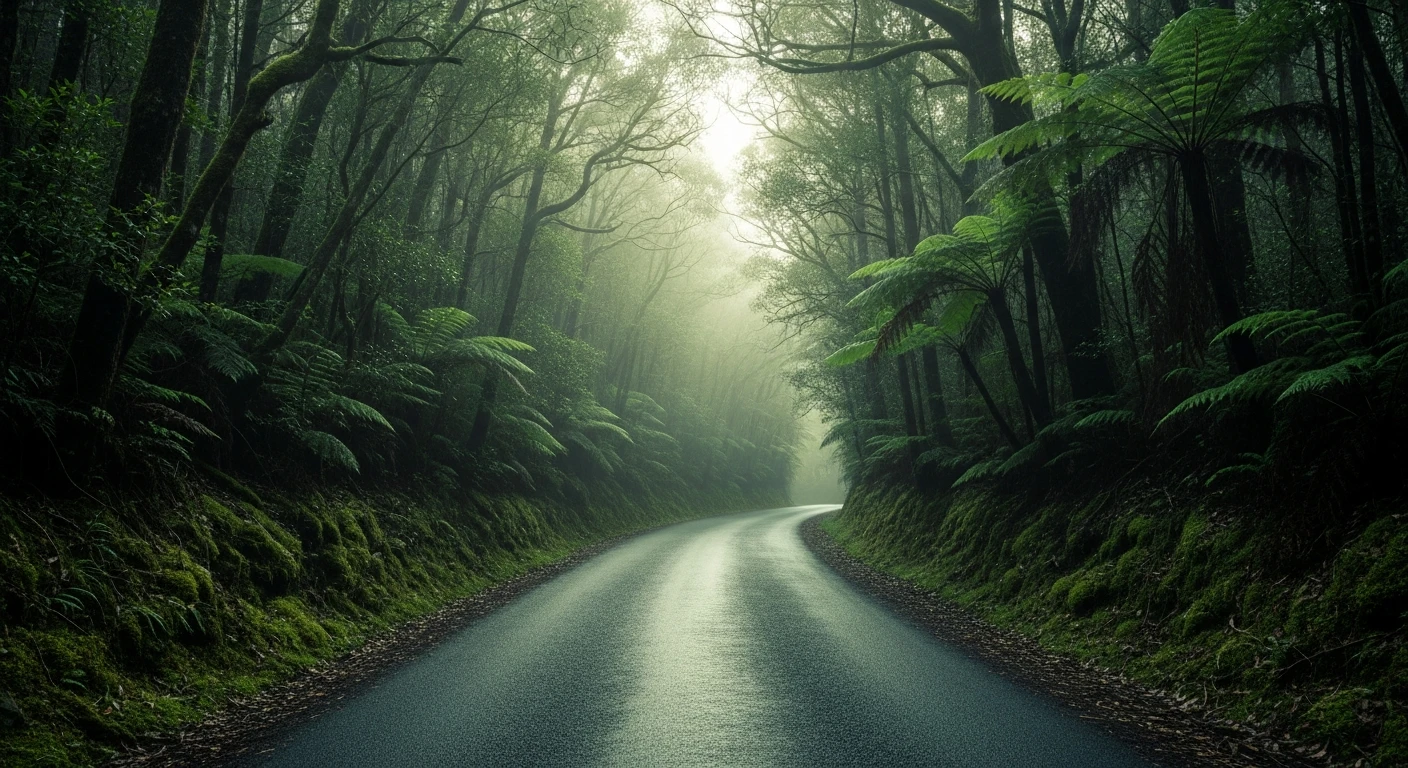
Outstanding asphalt road with constant corners and genuine remoteness. Sports car or motorbike are ideal. The road ends at Cockle Creek - the southernmost accessible point in Australia - which gives it a natural destination. Best October to April; winter conditions can be severe.
Scored 8.9/10 by Contour's road quality algorithm across curviness, surface, elevation and traffic. Best suited for sports car drivers.
The road
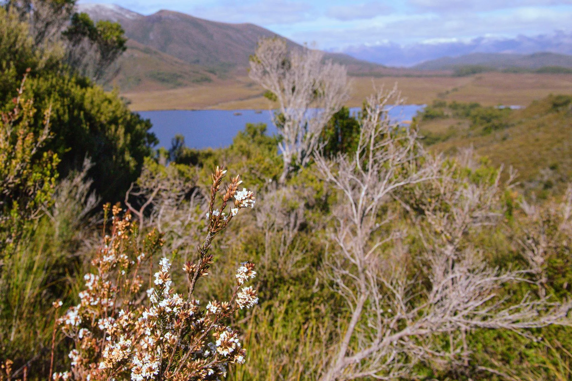
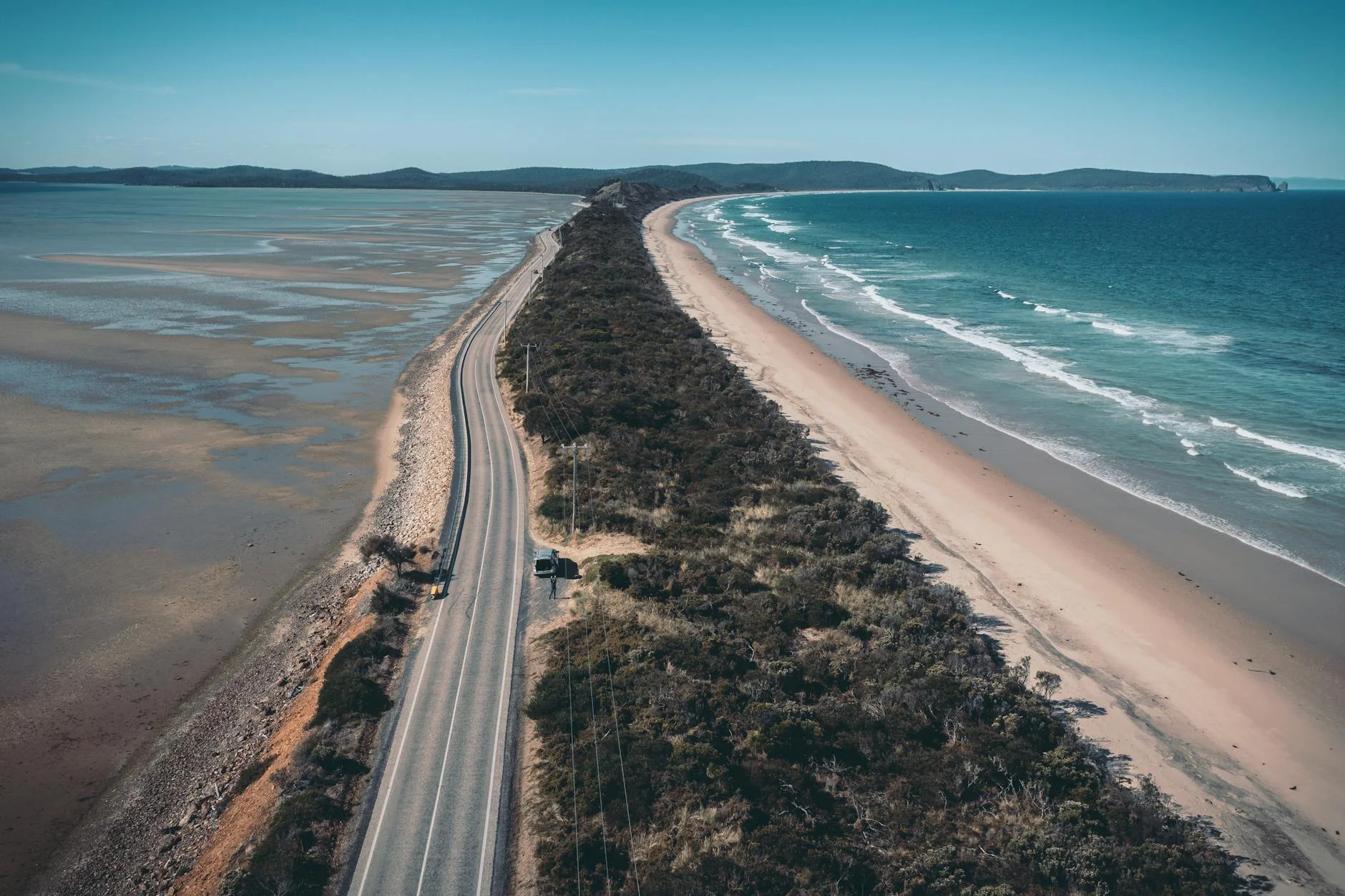
Esperance Coast Road is the sealed route to the southernmost road-accessible point in Australia. The 33-kilometre run from Southport to Cockle Creek follows the southeast Tasmanian coast through one of the most isolated stretches of sealed road in the country. The road delivers constant corners on excellent asphalt with views across D'Entrecasteaux Channel to Bruny Island. Cockle Creek at the end is not a town - it is a campsite at the boundary of Southwest National Park, a World Heritage wilderness of buttongrass plains, rainforest and glacially-carved coastline. There are no permanent residents. The bay was a whaling station in the 19th century and the site of the first European landing on Tasmanian soil, by Bruni D'Entrecasteaux in 1792. The combination of outstanding road quality, genuine remoteness and a definitive destination makes this one of Tasmania's best drives. The road ends. There is nothing beyond it except wilderness that continues to the Southern Ocean.
Esperance Coast Road is the sealed route to the southernmost road-accessible point in Australia.
Why this road

The region
The Esperance Bay area in southeast Tasmania is one of the most remote corners of the state. The road approaches Cockle Creek and the boundary of Southwest National Park - a World Heritage wilderness of buttongrass plains, rainforest and glacially-carved coast. There are no permanent residents at Cockle Creek. The coast road offers views across D'Entrecasteaux Channel to Bruny Island.
History
Cockle Creek was once a whaling station and later a tin mining site. The bay is also the site of the first European landing on Tasmanian soil, by Bruni D'Entrecasteaux in 1792.
Before you go
Fuel in Huonville (90 minutes north) or Dover. Carry extra. Road is sealed but remote. Mobile coverage is absent for most of the route. Summer (December to February) is the peak season for bushwalkers accessing the Southwest. Winter is cold and wet - check conditions. The basic campsite at Cockle Creek has pit toilets. Last petrol is at Dover.
See a routing error?
Flag itWorth stopping for
Cockle Creek
The end of the road and the southernmost point accessible by sealed road in Australia. Short beach walk to the monument.
Hastings Caves
A thermal pool and dolomite cave system north of Southport - the natural pool is one of the few warm swimming spots in southern Tasmania.
Route
Start
Southport
End
Cockle Creek
Gallery
More roads like this