Crooked River Track
8 km
distance
1h
Contour time
2.8
avg score
Unsealed
surface
Scenery
Victoria
The Crooked River country sits between Dargo and Licola in the Alpine National Park foothills. This was one of...
Road quality
2.8 RQS
Every segment scored on 40+ data signals.
Accessibility
Fully sealed
Best in 4WD. Peak season: November-April.
7-day forecast
Stock 4WD with decent clearance handles this in normal conditions. A snorkel is recommended because the crossings are frequent and some reach bonnet height after rain. The track is short enough that a stuck vehicle is never far from help.
Scored 2.8/10 by Contour's road quality algorithm across curviness, surface, elevation and traffic. Best suited for 4wd drivers.
The road
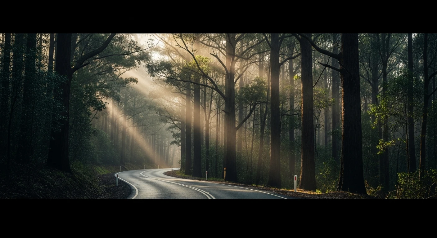
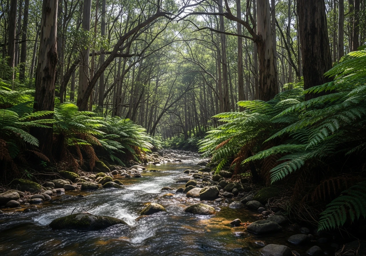
The Crooked River Track packs 24 river crossings into 8 kilometres of forested valley between Talbotville and the Grant Historic Area in Victoria's High Country. The crossings are the entire point. Every few hundred metres the track drops into the Crooked River, crosses a rocky or sandy bed, and climbs out the other side. In normal summer conditions the water is shin to knee deep and the bottom is firm. After rain the river rises fast and the crossings can reach bonnet height, which is where a snorkel earns its value. The track follows the river through a narrow valley with steep forested sides. The bush here is wet sclerophyll - mountain ash and stringybark with a thick fern understorey. The valley floor is shaded for most of the day and the water stays cold year-round. Between crossings the track is straightforward - compacted gravel and dirt with moderate ruts. There is nothing technically difficult about the driving itself. The challenge is volume - 24 crossings in quick succession means your vehicle is wet continuously, and anything electrical below the bonnet line gets tested. Talbotville at the starting end was a gold rush settlement in the 1860s and is now a popular camping area with basic facilities and flat ground along the river. The Grant Historic Area at the far end is the remains of a larger gold mining community - scattered stone walls, old mining equipment and interpretive signage explaining the layout of the settlement. The combination of constant water crossings and gold rush history makes this one of the most entertaining short 4WD tracks in the state.
The Crooked River Track packs 24 river crossings into 8 kilometres of forested valley between Talbotville and the Grant Historic Area in Victoria's High Country.
Why this road
The region
The Crooked River country sits between Dargo and Licola in the Alpine National Park foothills. This was one of Victoria's later gold discoveries - the Crooked River goldfield drew prospectors in the 1860s and several thousand people lived in the valley at the height of the rush. The gold ran out within a decade and the towns emptied, leaving stone foundations and tailings piles along the river. Talbotville is the main camping area and is accessible via Dargo or via the Wonnangatta Road from Licola.

Before you go
No fuel on the track. Fill up at Dargo. The crossings rise quickly after rain - check river conditions before going in. The track is short enough to retreat from if conditions deteriorate. No mobile coverage in the valley. Best done as part of a larger High Country loop including the Wonnangatta Valley or Billy Goat Bluff. A snorkel is not strictly essential in dry summer conditions but is strongly recommended given the frequency of crossings.
See a routing error?
Flag itWorth stopping for
Talbotville camping area
Flat riverside camping with basic facilities. A popular base for multi-day High Country trips combining several tracks.
Dargo Hotel
30 minutes away on sealed road. Good food and the best source of current track condition information in the area.
Route
Start
Talbotville
End
Grant Historic Area
Gallery

More roads like this