Blue Rag Range Track
16 km
distance
2h 30m
Contour time
3.0
difficulty
Unsealed
surface
1715m
max elevation
Scenery
1715m elevation
The Dargo High Plains are part of the Alpine National Park, accessed via the Dargo High Plains Road from Dargo in the...
Road quality
Grade 3
Every segment scored on 40+ data signals.
Accessibility
Fully sealed
Best in 4WD modified. Peak season: November-April.
7-day forecast
Modified 4WD recommended. The ridgeline is exposed and the ruts are deep in places. Stock vehicles can attempt it in perfect dry conditions but risk undercarriage contact. Short wheelbase preferred for the tight ridgetop turns.
Recommended gear: Snatch strap, Recovery boards, Hi-lift jack, Satellite comms.
The road
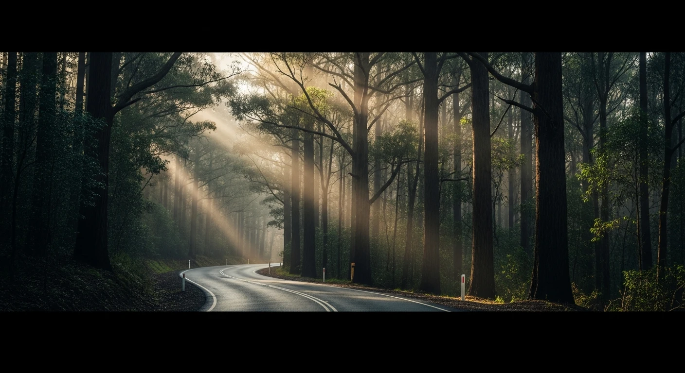
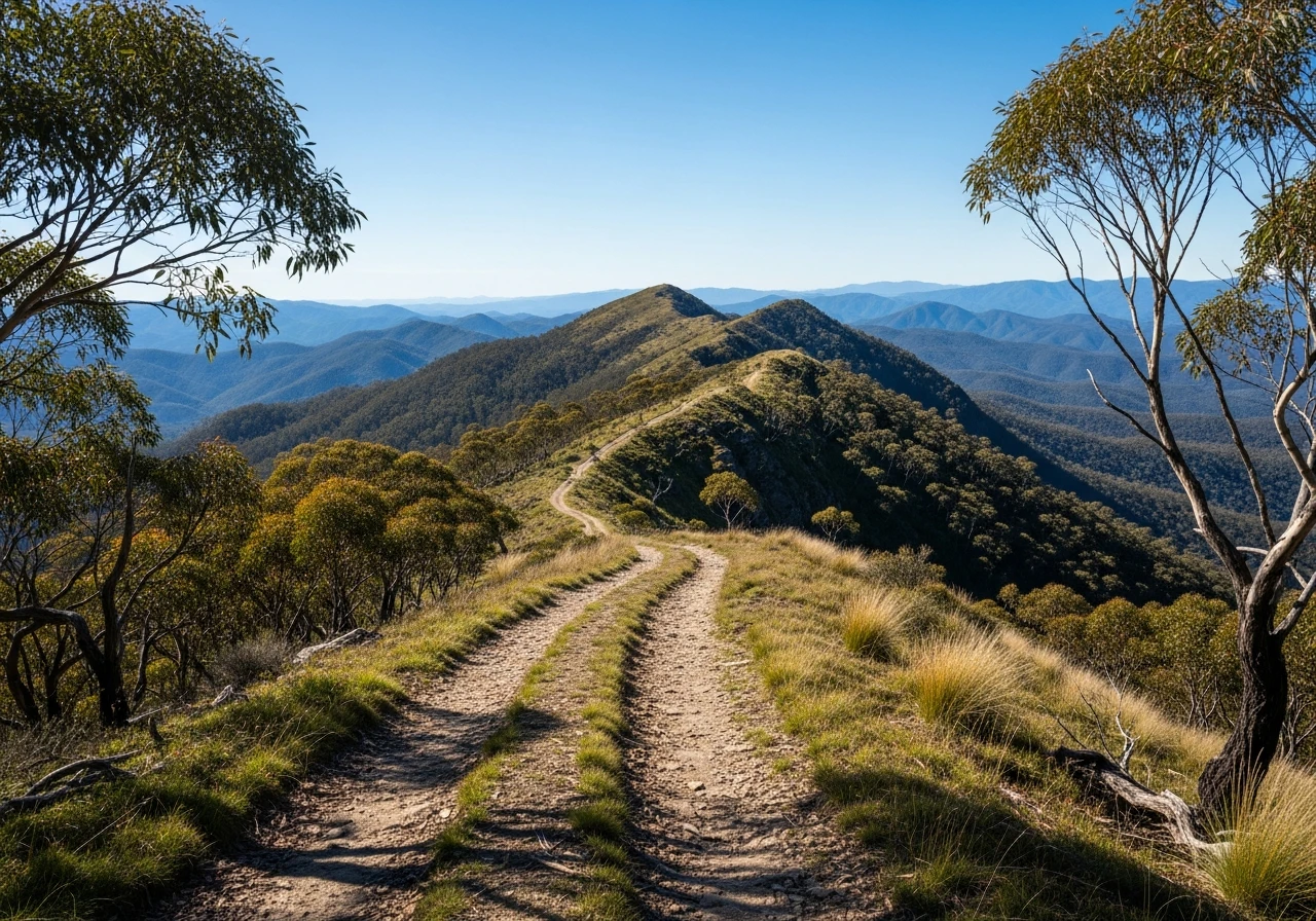
Blue Rag Range is the most scenic 4WD track in Victoria. The 16-kilometre route follows the ridgeline from the Dargo High Plains Road junction to the Wongungarra River descent, passing over Mt Blue Rag at 1,715 metres - one of the highest points accessible by vehicle in the state. The defining characteristic is exposure. For several kilometres the track runs along a narrow ridgeline with steep drops on both sides, the alpine air clear enough to see ranges extending in every direction. The snow gums thin out near the summit and the track crosses open subalpine grassland where the only thing above you is sky. The track itself is rocky and rutted, with several sections where the surface has been worn down to bare granite and quartz. Deep ruts from previous wet-weather driving have carved channels in the clay sections, and a modified 4WD with good clearance and articulation handles this far more comfortably than a stock vehicle. The descent towards the Wongungarra River on the southern end is steep and technical - loose rock and off-camber turns requiring careful line selection. The views from the summit of Mt Blue Rag are exceptional. On a clear day you can see Mt Hotham, Mt Feathertop and the Razorback ridge to the east, and the Wonnangatta Valley to the west. The alpine wildflowers in late spring are worth timing for. The exposed ridgeline means weather changes hit hard and fast - a clear morning can turn to fog and freezing rain within an hour at this elevation.
Blue Rag Range is the most scenic 4WD track in Victoria.
Why this road
The region
The Dargo High Plains are part of the Alpine National Park, accessed via the Dargo High Plains Road from Dargo in the south or from Hotham in the east. This is the roof of Victoria - the high country that sits above the treeline for several months of the year. The surrounding landscape is subalpine woodland and grassland, with snow gum forest on the lower slopes. Dargo is the nearest town with services - a small community that has served as a gateway to the High Country since the gold rush era. The area was badly burnt in the 2003 and 2006-07 alpine fires, and the regrowth adds a distinctive character to the ridgelines.

Before you go
No fuel on the track. Fill up at Dargo or Omeo. The track is strictly seasonal - closed by snow from June to October and impassable after heavy rain. No mobile coverage anywhere on the ridge. Weather at 1,700 metres changes rapidly - carry warm clothing even in summer. The descent to the Wongungarra is one-way in practice due to the gradient - plan your return via a different route. A satellite communicator is strongly recommended.
See a routing error?
Flag itWorth stopping for
Dargo Hotel
One of Victoria's best country pubs, dating from 1898. Good food, cold beer and reliable advice on track conditions from locals.
Grant Historic Area
An old gold mining settlement accessible via the Crooked River Track - worth combining with the Blue Rag trip for a multi-day High Country loop.
Route
Start
Dargo High Plains Road junction
End
Wongungarra River descent
Gallery

More roads like this