Bullen Fire Trail
6.5 km
distance
45 min
Contour time
7.4
avg score
Unsealed
surface
Scenery
Australian Capital Territory
The Bullen Range is one of the ridgelines framing Namadgi's northern approach, closest to Canberra's built edges....
Road quality
7.4 RQS
Strong. Above average on most quality signals.
Accessibility
Fully sealed
Best in 4WD. Peak season: Autumn-Spring.
7-day forecast
Moderate difficulty with consistent rocky sections. High clearance is the main requirement. No extreme obstacles but the surface deteriorates in patches. Suitable for a capable stock 4WD in dry conditions.
Scored 7.4/10 by Contour's road quality algorithm across curviness, surface, elevation and traffic. Best suited for 4wd drivers.
The road
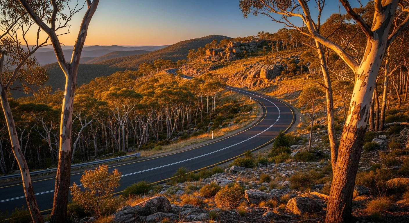
Bullen Fire Trail is a compact track in northern Namadgi with consistent rocky sections and granite outcrops. The trail passes through the Bullen Range - one of the ridgelines framing the park's northern approach closest to Canberra. Despite the proximity, the trail stays genuinely quiet. The surface deteriorates in patches with embedded rock requiring good tyre clearance. The Murrumbidgee valley views on clear days add visual reward to a trail that is otherwise about surface engagement. Tidbinbilla Nature Reserve 25 minutes east has koalas, eastern bettongs and the critically endangered southern corroboree frog.
Bullen Fire Trail is a compact track in northern Namadgi with consistent rocky sections and granite outcrops.
Why this road

The region
The Bullen Range is one of the ridgelines framing Namadgi's northern approach, closest to Canberra's built edges. Despite the proximity, this part of the park stays genuinely quiet. The trail passes through dry sclerophyll forest with granite outcrops and valley views toward the Murrumbidgee. It connects into the broader Namadgi fire trail network but sees little recreational 4WD use.

Before you go
Enter via Tidbinbilla or Gibraltar Creek Road from Canberra. Fuel in Canberra before departure. Check NPWS closure notices - the trail can be closed during high fire danger periods in summer. Recovery gear recommended. The track is passable in a standard high-clearance 4WD in dry conditions.
See a routing error?
Flag itWorth stopping for
Tidbinbilla Nature Reserve
25 minutes east - ACT's best wildlife sanctuary with koalas, eastern bettongs and platypus habitat.
Gibraltar Creek picnic area
A shaded picnic and creek swimming area on the approach road into Namadgi - good for a stop before or after the trail.
Route
Start
Northern Namadgi NP
End
Bullen Range upper track
Gallery

More roads like this