Old Marqua Bore - Christmas Dam Track
17 km
distance
2h
Contour time
4.5
difficulty
Unsealed
surface
Scenery
Northern Territory
The Plenty Highway crosses the Northern Territory from the Stuart Highway near Alice Springs to Boulia in Queensland -...
Road quality
Grade 4.5
Every segment scored on 40+ data signals.
Accessibility
Fully sealed
Best in 4WD modified. Peak season: Winter-Spring (Apr-Sep).
7-day forecast
Remote Central Australian station track requiring full expedition preparation. The difficulty is elevated and the recovery risk reflects the extreme remoteness - the Plenty Highway corridor is one of the most isolated tracks in the NT. No compromises on preparation.
Recommended gear: Recovery boards, Snatch strap, Hi-lift jack, Satellite comms (mandatory), Water (30L+), Spare tyre (full size), Fuel (300km range minimum).
The road
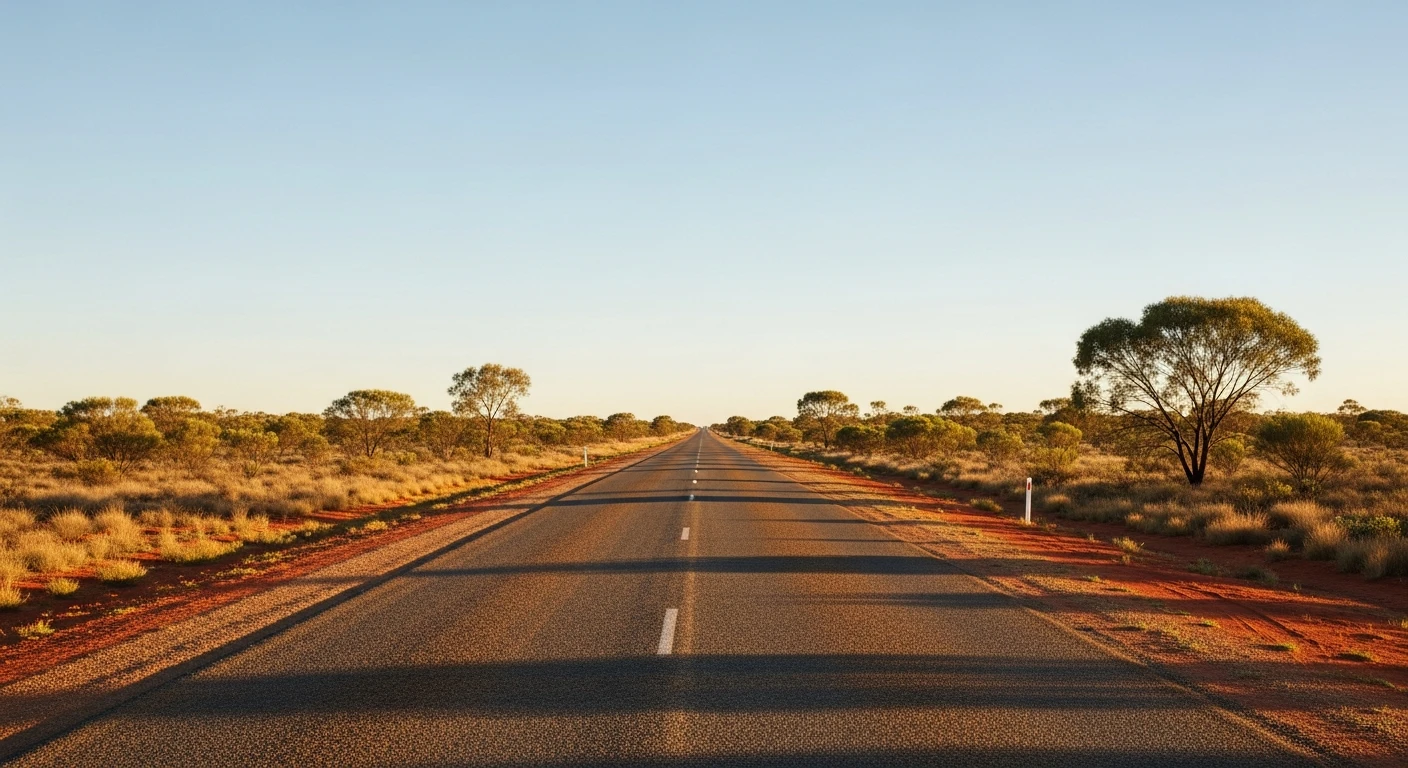
Old Marqua Bore - Christmas Dam Track runs through the Plenty Highway country east of Alice Springs - one of the most isolated inland corridors in Australia. The 17-kilometre track crosses red sand ridge desert with mulga and spinifex, connecting historical pastoral bore and dam infrastructure that dates from the era when this country was worked as station land. The difficulty of 4.5 and RRI of 6.03 reflect both the terrain and the extreme remoteness. The Plenty Highway itself runs from Alice Springs to Boulia in Queensland and some months sees fewer than a dozen vehicles. There is no margin for error in this country - minimum 30 litres of water, 300 km fuel range, satellite communicator and a detailed route plan shared with someone who will raise the alarm are all mandatory, not suggested. The reward is complete isolation in one of the world's great desert landscapes.
Old Marqua Bore - Christmas Dam Track runs through the Plenty Highway country east of Alice Springs - one of the most isolated inland corridors in Australia.
Why this road

The region
The Plenty Highway crosses the Northern Territory from the Stuart Highway near Alice Springs to Boulia in Queensland - one of Australia's most remote inland routes. The country around Marqua is sandstone and sand ridge desert with mulga and spinifex. The bore and dam infrastructure dates from the pastoral era when the land was worked as station country. The landscape is ancient and barely changed from the days of the first European drovers.

Before you go
Fuel in Alice Springs. The Plenty Highway region requires full expedition preparation: minimum 30L water, 300km fuel range, satellite communicator, detailed topographic maps and a PLB. Inform park rangers or a trusted contact of your complete route plan. Dry season only - June through August ideal.
See a routing error?
Flag itWorth stopping for
Plenty Highway
The full unsealed highway crossing from Alice to Boulia is one of Australia's great remote outback drives - allow 2-3 days for the full crossing.
Harts Range
The gemstone-rich range north of the Plenty Highway - mica, feldspar and semi-precious stones are found in the pegmatite outcrops around Atitjere (Harts Range).
Route
Start
Plenty Highway region
End
Christmas Dam
Gallery

More roads like this