Lions Road
96 km
distance
2h
Contour time
4.5
avg score
Sealed
surface
900m
max elevation
+650m
total climb
Scenery
900m elevation
The Border Ranges form the NSW-Queensland border west of the Gold Coast hinterland. The ranges are the remnant rim of...
Road quality
4.5 RQS
Every segment scored on 40+ data signals.
Accessibility
Fully sealed
Best in Motorbike & Rally. Peak season: Autumn-Spring.
7-day forecast
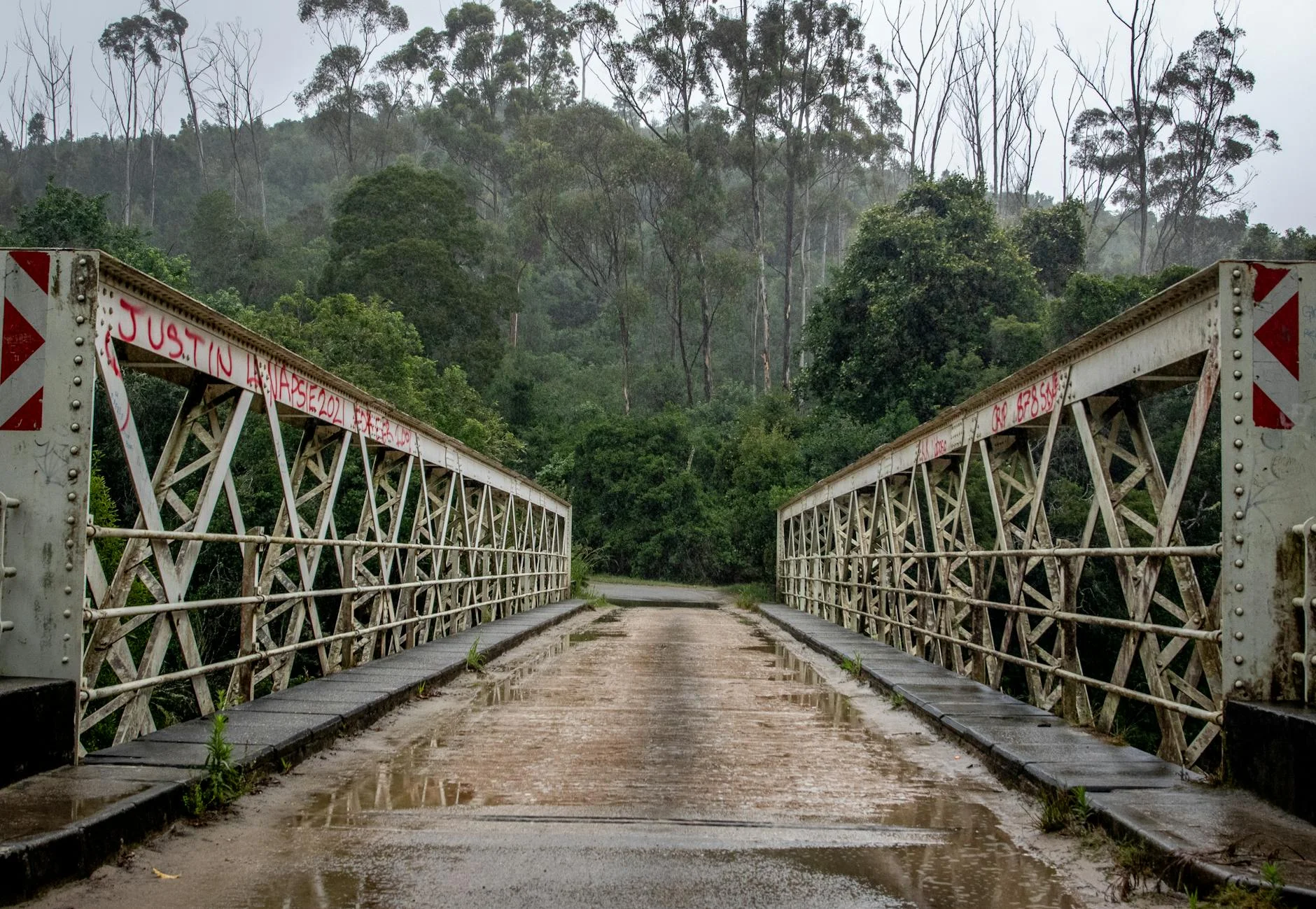
Narrow sealed road through rainforest and mountain country. The splash crossings and single-lane sections suit motorcycles and small cars. Not suitable for trailers or caravans. The road demands attention and moderate speed throughout.
Scored 4.5/10 by Contour's road quality algorithm across curviness, surface, elevation and traffic. Best suited for motorbike & rally drivers.
The road
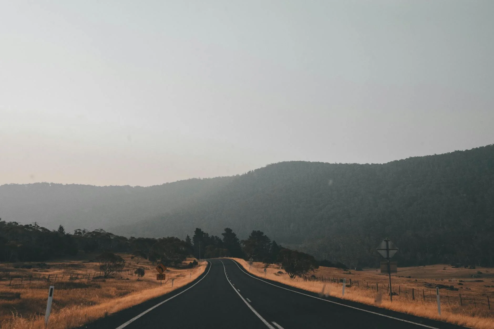
Lions Road connects Kyogle in northern NSW to Rathdowney in south-east Queensland via the McPherson Range and the Border Ranges National Park. The 96-kilometre road was built almost entirely by volunteers from the Kyogle Lions Club in the early 1970s after the NSW Government rejected the proposal. It was sealed with bitumen in the 1990s but the original alignment was largely unchanged, which means it follows the terrain rather than cutting through it. The road is narrow - single lane for significant stretches - and crosses six splash crossings on the NSW side that can become impassable after heavy rain. The rainforest through the Border Ranges section is World Heritage listed as part of the Gondwana Rainforests of Australia. The canopy closes over the road in the upper sections and the understorey is thick enough to feel enclosed. The crossing of the McPherson Range at the NSW-Queensland border is the high point - both literally and in terms of driving quality. The descent into the Running Creek valley on the Queensland side opens up with pastoral views before reaching Rathdowney. The whole road has a character that is difficult to find elsewhere - built by community effort, maintained to a basic standard, and used primarily by people who specifically want to be on it.
Lions Road connects Kyogle in northern NSW to Rathdowney in south-east Queensland via the McPherson Range and the Border Ranges National Park.
Why this road
The region
The Border Ranges form the NSW-Queensland border west of the Gold Coast hinterland. The ranges are the remnant rim of the Tweed Shield Volcano, which erupted 23 million years ago and created the caldera that Mount Warning sits at the centre of. The World Heritage rainforest in the Border Ranges is some of the most intact subtropical and warm temperate rainforest remaining in Australia. Kyogle is a small town on the Richmond River, historically a dairy and timber centre. Rathdowney in the Scenic Rim region of Queensland is a one-pub town surrounded by grazing country.
Before you go
Fuel in Kyogle and Rathdowney. There are no services on the road itself. The splash crossings on the NSW side can rise quickly after rain - check conditions before going, particularly between December and March. The road is not suitable for caravans, trailers or vehicles over a certain height due to low rail bridges. Phone coverage is limited through the Border Ranges section. Note: the NSW section of Lions Road has been subject to periodic closures for landslip repairs - check Kyogle Council road status before planning a trip. Allow two hours without stops.
See a routing error?
Flag itWorth stopping for
Border Ranges National Park
The road passes through the park. Several short walking tracks are accessible from the road - the Bar Mountain lookout gives views across the Tweed Valley caldera.
Mount Warning (Wollumbin)
40 minutes east of Kyogle. The central plug of the ancient Tweed Shield Volcano. The summit walk is currently closed for cultural reasons but the surrounding national park has other tracks.
Rathdowney pub
A one-pub town in the Queensland Scenic Rim. Cold beer, basic food and a good place to sit after two hours of rainforest road.
Route
Start
Kyogle
End
Rathdowney
Gallery

