Halls Road
6.5 km
distance
45 min
Contour time
7.6
avg score
Unsealed
surface
Scenery
South Australia
The southern SA farm country between Yorke Peninsula and the lower Eyre Peninsula is one of the state's most productive...
Road quality
7.6 RQS
Strong. Above average on most quality signals.
Accessibility
Fully sealed
Best in 4WD. Peak season: Autumn-Spring.
7-day forecast
Low to moderate difficulty SA farm country track. Limestone and loam surface typical of the southern SA pastoral fringe. Good for beginners or a gentle intro to SA 4WD terrain.
Scored 7.6/10 by Contour's road quality algorithm across curviness, surface, elevation and traffic. Best suited for 4wd drivers.
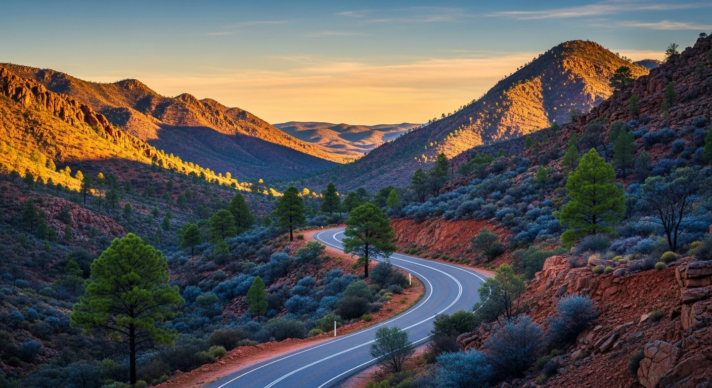
The road
Halls Road is a 6.5-kilometre farm country track in the southern SA wheat belt, the kind of road that does not appear on tourist maps but gives you a genuine feel for the landscape that produces most of South Australia's grain. The surface is limestone over red-brown loam - the characteristic soil type of the southern pastoral fringe. The difficulty is low enough to make this a good introduction to SA 4WD terrain. Any AWD or 4WD handles the surface in dry conditions. The appeal is not technical challenge but landscape immersion: low rolling hills with granite outcrops on the higher ridges, cleared paddocks that have been producing wheat and barley since the 1850s, and the quiet that comes from being genuinely off the main road network. Innes National Park at the southern tip of Yorke Peninsula is the natural pairing for a day trip from this area. The rugged coastal cliffs, surf beaches and the ghost town of Inneston from the gypsum mining era are worth the drive. The Copper Triangle towns of Kadina, Wallaroo and Moonta are 40 to 60 minutes away with well-preserved 1860s copper mining architecture and good seafood.
Why this road

The region
The southern SA farm country between Yorke Peninsula and the lower Eyre Peninsula is one of the state's most productive wheat and barley zones. The landscape is low rolling hills of limestone over red-brown loam with granite outcrops on the higher ridges. Very few visitors penetrate beyond the main roads in this area - it is genuine back-country SA without the desert remoteness of the far north.

Before you go
Fuel at nearest town. Standard recovery kit. Best in the April-October dry period. Check conditions locally.
See a routing error?
Flag itWorth stopping for
Innes National Park
At the southern tip of Yorke Peninsula - rugged coastal cliffs, good surfing and the historic Inneston townsite from the gypsum mining era.
Yorke Peninsula coastal towns
The Copper Triangle towns of Kadina, Wallaroo and Moonta are 40-60 minutes away - well-preserved 1860s copper mining architecture and good seafood.
Route
Start
Southern SA farm country
End
Halls Road end
Gallery

More roads like this