Edith Falls Road
19 km
distance
22 min
Contour time
4.8
avg score
Sealed
surface
Scenery
Northern Territory
Edith Falls Road runs through the outliers of Nitmiluk National Park, approaching the Edith River escarpment country....
Road quality
4.8 RQS
Every segment scored on 40+ data signals.
Accessibility
Fully sealed
Best in Sports car. Peak season: May-September.
7-day forecast
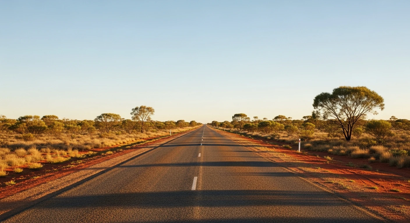
Open sealed road through Top End savanna. Not technical - the appeal is the landscape and the light, not corner count. EV handles this well in the dry season. Avoid in the wet season (November to March) when the road can flood and the falls are dangerous for swimming.
Scored 4.8/10 by Contour's road quality algorithm across curviness, surface, elevation and traffic. Best suited for sports car drivers.
The road
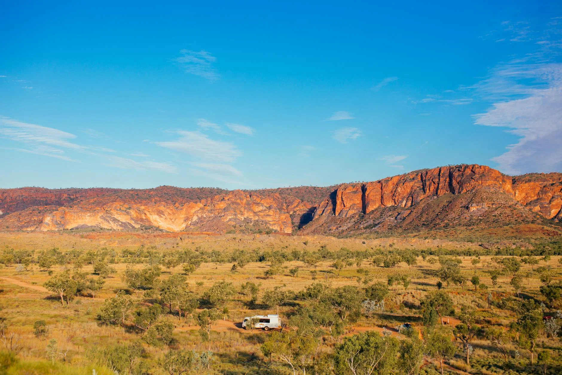
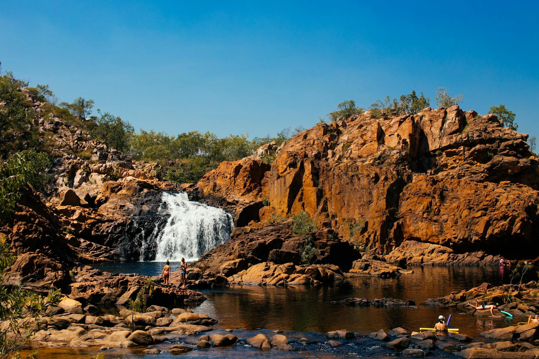
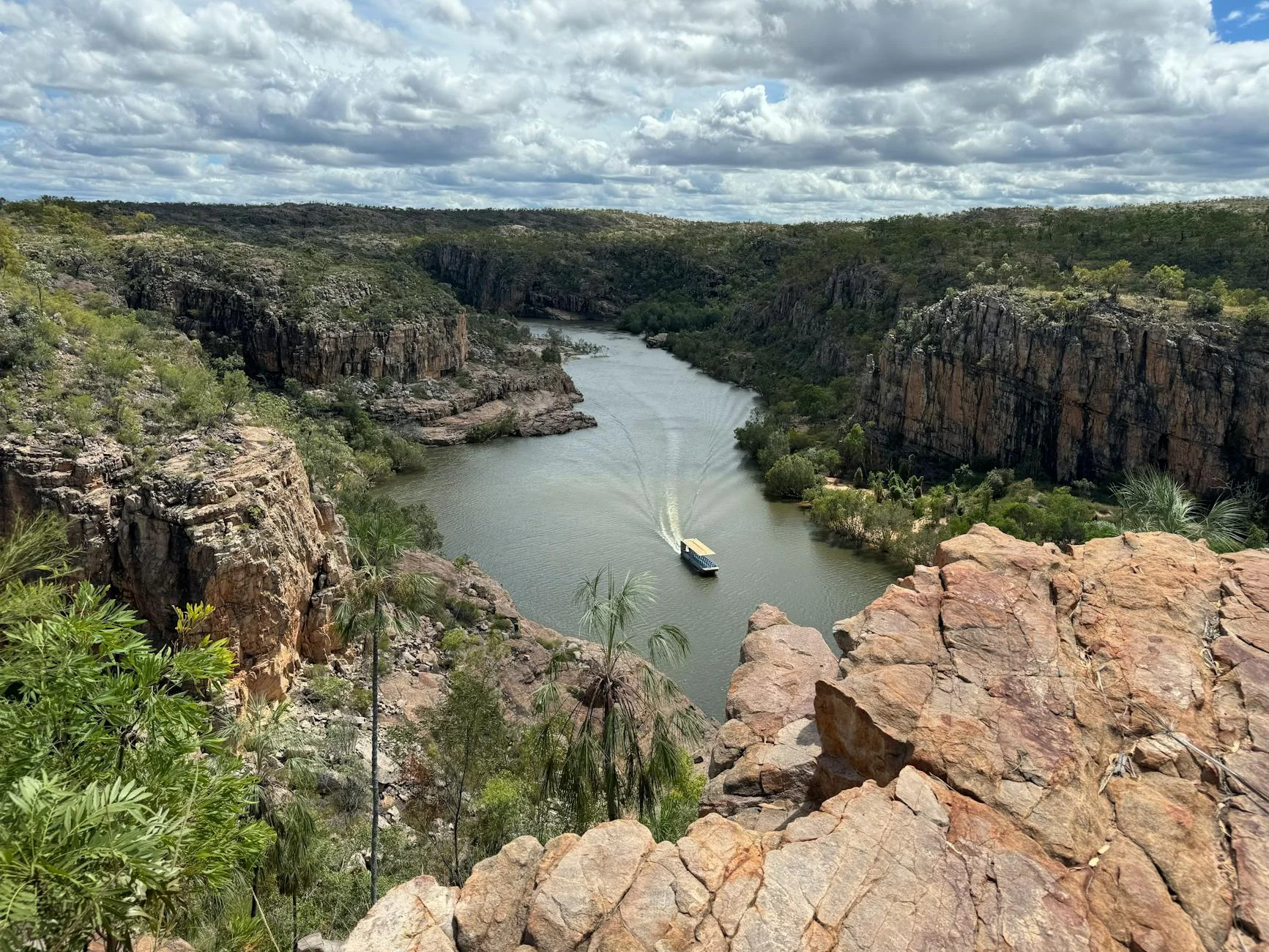
Edith Falls Road is a 19-kilometre sealed approach through open Top End savanna to Leliyn - one of the best freshwater swimming spots in the Northern Territory. The road runs through Darwin woollybutt and bloodwood woodland with termite mounds up to 6 metres tall lining the route. This is not a technical driving road - the appeal is entirely in the landscape and the light. The Top End dry season produces a quality of light that is unlike anywhere else in Australia - golden, warm, with the red soil glowing under the low sun. The Edith River at the end is spring-fed and runs clear year-round, with a series of tiered rockpools and small waterfalls that are among the best freshwater swimming in the Territory. Katherine Gorge (Nitmiluk) is 35 km south on the Stuart Highway for a gorge canoe tour.
Edith Falls Road is a 19-kilometre sealed approach through open Top End savanna to Leliyn - one of the best freshwater swimming spots in the Northern Territory.
Why this road
The region
Edith Falls Road runs through the outliers of Nitmiluk National Park, approaching the Edith River escarpment country. The Top End savanna here is open woodland with Darwin woollybutt and bloodwood - sparse canopy, red soil and termite mounds. The Edith River itself is spring-fed, running clear year-round, and the swimming holes at Leliyn are among the best in the Territory.
Before you go
Fuel at Katherine (35 km south on the Stuart Highway). Road is sealed and open year-round but best May to September. The wet season brings flooding risk and the falls swimming area closes when flows are dangerous. The campsite at Leliyn has facilities. Mobile coverage is limited. No fuel at Edith Falls.
See a routing error?
Flag itWorth stopping for
Leliyn swimming holes
A series of tiered rockpools and small waterfalls fed by the Edith River spring system - some of the best freshwater swimming in the Territory.
Katherine Gorge (Nitmiluk)
The main gorge attraction is 30 minutes south - canoe hire and gorge tours available.
Route
Start
Stuart Highway
End
Leliyn (Edith Falls)
Gallery
More roads like this