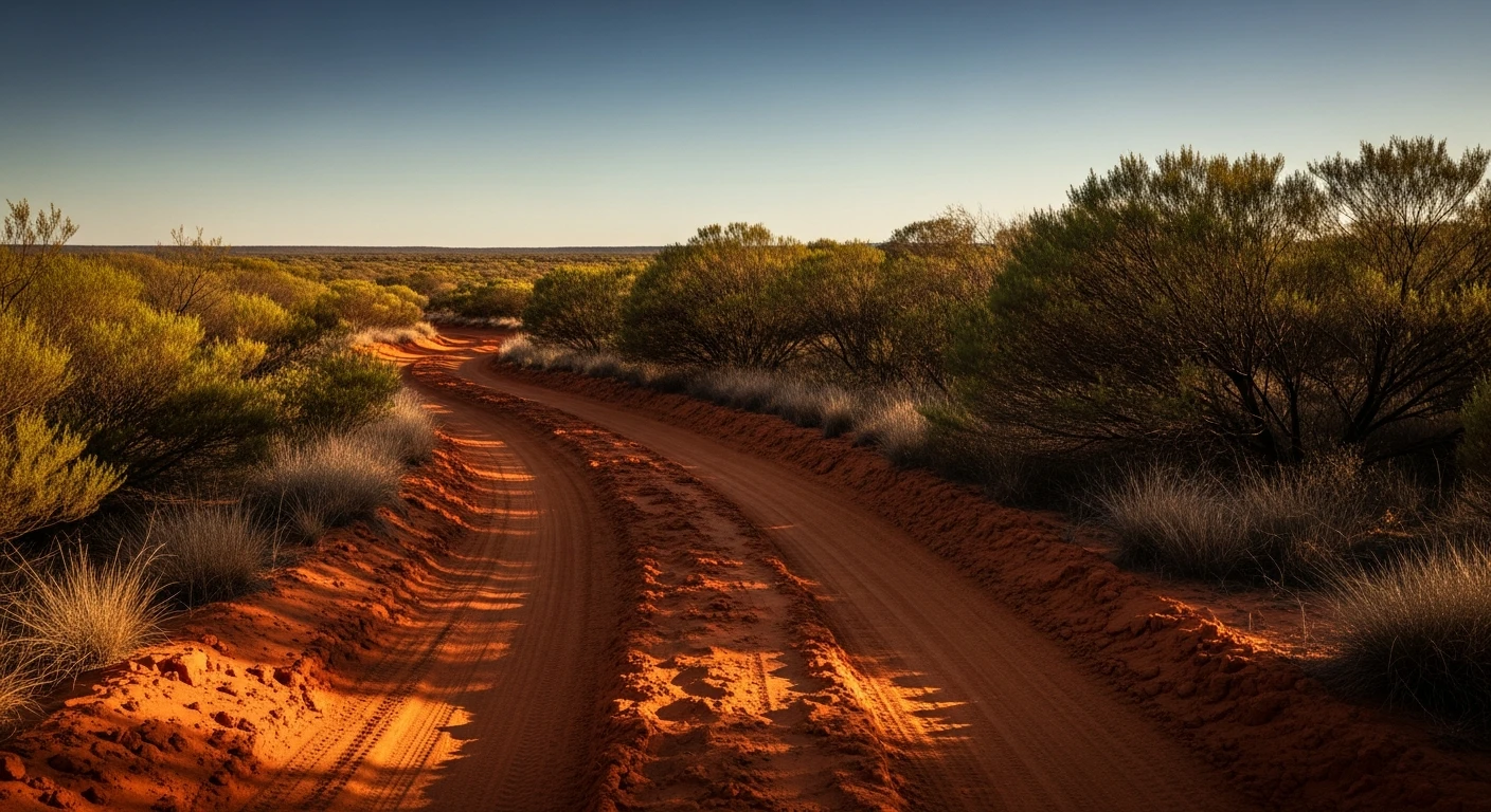
4WD & tracks
Looking for a Hema alternative?
Contour rates every 4WD track in Australia with a difficulty score and Recovery Risk Index - the data Hema Explorer never had. Find tracks that match your rig. Know the risk before you leave the bitumen.
What happened to Hema Explorer
Hema shut down the 4X4 Explorer app and discontinued cloud services in September 2024. Thousands of paying users - many of them multi-year subscribers at A$49.99/year - lost a product they depended on for remote 4WD trips. Downloaded offline maps became inaccessible. The community was not given adequate notice.
The replacement app (Hema 4WD Maps, bundled with Hema Nav) launched to sub-2-star App Store reviews. Documented user complaints: tracks that were in Explorer are missing; contrast is poor on the new map style; data accuracy has regressed on remote routes. Hema promised new products in Q1 2025. As of 2026, user trust has not recovered.
The Australian 4WD navigation market is fragmented. ExplorOz has gained the most ex-Hema subscribers. GaiaGPS has some. Neither product offers what experienced 4WD drivers actually want: a calibrated difficulty rating for every track, a recovery risk score for remote areas, and vehicle profiles that filter tracks to what your rig can handle.
What Hema never had
Two features that experienced 4WD drivers actually need - and that no Australian app has provided consistently.
Calibrated difficulty
Grade 1-5 for every track
Hema listed tracks. The difficulty rating was inconsistent - "medium" in one state meant something different to "medium" in another. The rating didn't account for your specific vehicle.
Contour uses a 1-5 difficulty scale calibrated against known benchmark tracks, with separate Stock and Modified vehicle profiles. Grade 3 means Grade 3 anywhere in Australia.
Recovery Risk Index
What happens if you get stuck
The question experienced 4WD drivers actually ask before a remote track: if something goes wrong here, how hard is recovery? Hema gave you a track line. It didn't give you an answer to that question.
RRI is a 0-10 score per track: distance to sealed road, mobile coverage, drive frequency, and whether the track dead-ends or loops. Every track. Every state.
Hema Explorer vs Contour
An honest comparison. Hema had strengths. So does Contour. They're different products.
| Feature | Hema Explorer | Contour |
|---|---|---|
| Track difficulty rating | Inconsistent. No standardised scale across the country. | Grade 1-5 for every track. Calibrated against known benchmarks. Every state. |
| Recovery Risk Index | Not available. | 0-10 score per track. Factors: distance to sealed road, mobile coverage, drive frequency, loop vs dead-end. |
| Vehicle profiles | Generic 4WD only. | Stock 4WD (Grade 1-3) and Modified (Grade 1-5). Different track sets per profile. |
| Condition reports | Limited community reporting. No expiry system. | Community condition reports with 7-day expiry. Water crossing depth, passability, surface condition. |
| Data currency | Historical proprietary data. Known accuracy issues on remote tracks. | OpenStreetMap base (continuously updated) plus Contour classification pipeline. Community-validated. |
| Offline maps | Was core feature. Discontinued with Explorer shutdown. | Offline maps in the mobile app via MapTiler. Auto-switch on connectivity loss. |
| Map quality | Strong historical topographic detail. New product (Hema 4WD Maps) rated poorly. | OSM-based with outdoor tileset. Track lines accurate for scored tracks. Topo detail improving. |
| Route planning | Basic A-to-B. No scenic routing algorithm. | Route planner with difficulty-filtered waypoints. Sends to Google Maps with full route pre-loaded. |
| Price | A$49.99/year (historical). New product pricing varies. | Free tier (Discover + limited routes). Pro: A$65/year (unlimited routes, all profiles, offline). |
Hema data reflects Hema Explorer (pre-September 2024) and available information about Hema 4WD Maps (2024-2026). Contour data as of March 2026.
Track intelligence
Know the grade. Know the risk.
Every 4WD track gets a difficulty grade (1-5) calibrated against benchmark tracks, plus a Recovery Risk Index (0-10) that factors in distance to sealed road, mobile coverage, drive frequency, and whether the track loops or dead-ends. The question experienced drivers ask isn't 'can I drive this?' - it's 'what happens if something goes wrong?'
See track gradesWhat Contour doesn't replace
Honesty matters when the stakes are a remote 4WD track. Contour does some things Hema didn't. Hema did some things Contour doesn't.
- Detailed topographic maps. Hema's topo maps were its core product. Contour uses an OSM outdoor tileset - functional for track navigation, but not the same depth of topographic detail as dedicated topo maps.
- Campsite and POI database. Hema and ExplorOz both have large campsite databases. Contour is focused on road and track quality, not POI. Use ExplorOz for campsites alongside Contour for tracks.
- Some very remote station tracks. Contour uses OSM as its base. Tracks on private pastoral stations that were never added to OSM may not appear. OSM coverage is improving continuously, but remote outback tracks may have gaps.
4WD track coverage by state
Contour covers 4WD tracks across all 8 Australian states. Coverage depth varies - WA, NT, and QLD have the largest track networks.
Common questions
Why are 4WD drivers looking for a Hema alternative?
Hema shut down the 4X4 Explorer app in September 2024 and discontinued cloud services. Thousands of users lost a product they depended on. The replacement app (Hema 4WD Maps) has been rated poorly - documented issues include missing tracks, inaccurate data, and poor contrast. As of 2026, the Australian 4WD navigation market remains fragmented.
Is Contour a direct replacement for Hema Explorer?
Contour is different from Hema rather than a direct swap. Hema's strength was detailed proprietary topographic maps and a large historical track database. Contour's strength is track difficulty scoring, Recovery Risk Index, vehicle profiles, and route planning. Many drivers use both - Hema (or ExplorOz) for map detail, Contour for planning and risk assessment.
What's the Recovery Risk Index and why does it matter?
RRI is a 0-10 score that measures how isolated you are if your vehicle breaks down on a track. It factors in: distance to nearest sealed road, mobile coverage classification, how often the track is driven (low-traffic tracks mean longer waits for help), and whether the track is a loop or dead-end. Hema never had a score like this. It's the difference between knowing a track is Grade 3 and knowing what happens if Grade 3 goes wrong.
Does Contour have offline maps?
Yes. The Contour mobile app uses MapTiler for offline map tiles. Download a region before you leave coverage. The app automatically switches from online Google Maps to offline MapTiler when connectivity drops.
Does Contour have all the tracks Hema had?
Contour uses OpenStreetMap as its base, which covers the vast majority of documented 4WD tracks in Australia. Remote station tracks and some pastoral roads that were in Hema's proprietary dataset may not be in OSM yet - the community is actively adding them. For very remote and obscure tracks, cross-reference with local trip reports and land manager resources.
Is Contour free?
The free tier includes: unlimited Discover mode browsing (road quality heatmap and track layer), and 10 route plans per month with the Sports Car profile. Pro (A$65/year) unlocks all vehicle profiles including 4WD Stock and Modified, unlimited route planning, offline maps, and Journey Builder.
What about ExplorOz? How does Contour compare?
ExplorOz is the largest beneficiary of the Hema vacuum. It has a strong POI database (campsites, stations, water points) and is actively gaining ex-Hema users. Contour focuses on different strengths: difficulty ratings, Recovery Risk Index, vehicle profiles, and scenic route planning. For campsite databases and POI-heavy touring, ExplorOz is a strong choice. For understanding which tracks you're equipped for and what the risk is, Contour adds a layer ExplorOz doesn't have.